

Camino portugues
From Pontevedra to Pontecesures
A cycling route starting in Pontevedra, Galicia, Spain.
Overview
About this route
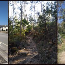
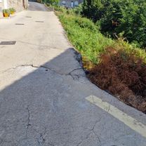
The route stats going around forests and vineyards, with lots of pilgrims walking in the first part of the day. Long satisfying lunch in Caldas de Reis. Lost the way and went around quite a bit afterwards. :) Winding left and right to avoid both the highway and the "N", busy road, the path goes through picturesque villages, and some paved, beautiful forest roads, to end up in the east, hilly part of Pontecesures.
- -:--
- Duration
- 42.7 km
- Distance
- 334 m
- Ascent
- 343 m
- Descent
- ---
- Avg. speed
- ---
- Max. altitude

Part of
6 stages
Continue with Bikemap
Use, edit, or download this cycling route
You would like to ride From Pontevedra to Pontecesures or customize it for your own trip? Here is what you can do with this Bikemap route:
Free features
- Save this route as favorite or in collections
- Copy & plan your own version of this route
- Sync your route with Garmin or Wahoo
Premium features
Free trial for 3 days, or one-time payment. More about Bikemap Premium.
- Navigate this route on iOS & Android
- Export a GPX / KML file of this route
- Create your custom printout (try it for free)
- Download this route for offline navigation
Discover more Premium features.
Get Bikemap PremiumFrom our community
Other popular routes starting in Pontevedra
 Serra do suido (cara pontevedra)
- Distance
- 86.2 km
- Ascent
- 1,405 m
- Descent
- 1,404 m
- Location
- Pontevedra, Galicia, Spain
 Day #13 Pontevedra to Padron
- Distance
- 41.6 km
- Ascent
- 363 m
- Descent
- 371 m
- Location
- Pontevedra, Galicia, Spain
 Etapa 6 Camino Portugués
- Distance
- 41.9 km
- Ascent
- 355 m
- Descent
- 367 m
- Location
- Pontevedra, Galicia, Spain
 Rúa Santa Clara nach Camiño Esperón
- Distance
- 18.6 km
- Ascent
- 371 m
- Descent
- 283 m
- Location
- Pontevedra, Galicia, Spain
 Pontevedra - O Grove - Pontevedra 77,4km
- Distance
- 77.4 km
- Ascent
- 505 m
- Descent
- 505 m
- Location
- Pontevedra, Galicia, Spain
 Camino Santiago 2014
- Distance
- 40.6 km
- Ascent
- 333 m
- Descent
- 351 m
- Location
- Pontevedra, Galicia, Spain
 Serra do Suido (Coto dos Xarotos)
- Distance
- 106.5 km
- Ascent
- 1,607 m
- Descent
- 1,607 m
- Location
- Pontevedra, Galicia, Spain
 Pontevedra Famelga
- Distance
- 40.5 km
- Ascent
- 719 m
- Descent
- 719 m
- Location
- Pontevedra, Galicia, Spain
Open it in the app