

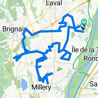
boucle ternay luzinay chaponay
A cycling route starting in Irigny, Auvergne-Rhône-Alpes, France.
Overview
About this route
route sympa, nombreuses variantes possibles
- -:--
- Duration
- 47.1 km
- Distance
- 339 m
- Ascent
- 335 m
- Descent
- ---
- Avg. speed
- ---
- Max. altitude
Route quality
Waytypes & surfaces along the route
Waytypes
Busy road
22.1 km
(47 %)
Quiet road
13.9 km
(29 %)
Surfaces
Paved
25.9 km
(55 %)
Asphalt
25.6 km
(54 %)
Paved (undefined)
0.3 km
(<1 %)
Undefined
21.2 km
(45 %)
Continue with Bikemap
Use, edit, or download this cycling route
You would like to ride boucle ternay luzinay chaponay or customize it for your own trip? Here is what you can do with this Bikemap route:
Free features
- Save this route as favorite or in collections
- Copy & plan your own version of this route
- Sync your route with Garmin or Wahoo
Premium features
Free trial for 3 days, or one-time payment. More about Bikemap Premium.
- Navigate this route on iOS & Android
- Export a GPX / KML file of this route
- Create your custom printout (try it for free)
- Download this route for offline navigation
Discover more Premium features.
Get Bikemap PremiumFrom our community
Other popular routes starting in Irigny
 boucle ternay luzinay chaponay
- Distance
- 47.1 km
- Ascent
- 339 m
- Descent
- 335 m
- Location
- Irigny, Auvergne-Rhône-Alpes, France
 orlienas taluyers
- Distance
- 29.5 km
- Ascent
- 368 m
- Descent
- 364 m
- Location
- Irigny, Auvergne-Rhône-Alpes, France
 Rue du Vieux Port, Irigny nach Loire-sur-Rhône
- Distance
- 18.1 km
- Ascent
- 159 m
- Descent
- 168 m
- Location
- Irigny, Auvergne-Rhône-Alpes, France
 Facile à conduire Saint-Genis-Laval
- Distance
- 4.2 km
- Ascent
- 72 m
- Descent
- 66 m
- Location
- Irigny, Auvergne-Rhône-Alpes, France
 De 3 Côte Carmagnac, Irigny à 59 Rue du Général Degoutte, Miribel
- Distance
- 27.2 km
- Ascent
- 107 m
- Descent
- 147 m
- Location
- Irigny, Auvergne-Rhône-Alpes, France
 pamplona-lyon
- Distance
- 1,001.8 km
- Ascent
- 1,780 m
- Descent
- 1,604 m
- Location
- Irigny, Auvergne-Rhône-Alpes, France
 De Rue du Mai à Rue du Mai
- Distance
- 37.1 km
- Ascent
- 331 m
- Descent
- 378 m
- Location
- Irigny, Auvergne-Rhône-Alpes, France
 irigny - obs par le bas
- Distance
- 9.3 km
- Ascent
- 152 m
- Descent
- 61 m
- Location
- Irigny, Auvergne-Rhône-Alpes, France
Open it in the app