

Temple to Ho Ho Kam
A cycling route starting in Peoria, Arizona, United States.
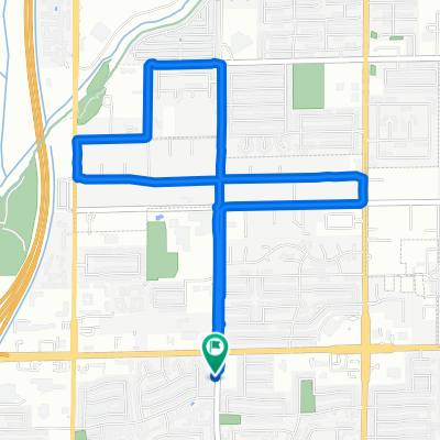
Overview
About this route
- 4 h 34 min
- Duration
- 64.8 km
- Distance
- 205 m
- Ascent
- 261 m
- Descent
- 14.2 km/h
- Avg. speed
- ---
- Max. altitude
Continue with Bikemap
Use, edit, or download this cycling route
You would like to ride Temple to Ho Ho Kam or customize it for your own trip? Here is what you can do with this Bikemap route:
Free features
- Save this route as favorite or in collections
- Copy & plan your own version of this route
- Sync your route with Garmin or Wahoo
Premium features
Free trial for 3 days, or one-time payment. More about Bikemap Premium.
- Navigate this route on iOS & Android
- Export a GPX / KML file of this route
- Create your custom printout (try it for free)
- Download this route for offline navigation
Discover more Premium features.
Get Bikemap PremiumFrom our community
Other popular routes starting in Peoria
 7431 W Tierra Buena Ln, Peoria to 15818 N 73rd Ln, Peoria
- Distance
- 17.8 km
- Ascent
- 418 m
- Descent
- 415 m
- Location
- Peoria, Arizona, United States
 Slow ride in Peoria
- Distance
- 16.5 km
- Ascent
- 550 m
- Descent
- 549 m
- Location
- Peoria, Arizona, United States
 Steady ride in Peoria
- Distance
- 6.7 km
- Ascent
- 10 m
- Descent
- 9 m
- Location
- Peoria, Arizona, United States
 dark ride
- Distance
- 13.9 km
- Ascent
- 39 m
- Descent
- 50 m
- Location
- Peoria, Arizona, United States
 Bikemap route
- Distance
- 10.3 km
- Ascent
- 21 m
- Descent
- 22 m
- Location
- Peoria, Arizona, United States
 Willpower
- Distance
- 64.9 km
- Ascent
- 124 m
- Descent
- 122 m
- Location
- Peoria, Arizona, United States
 Restful route in Peoria
- Distance
- 18.5 km
- Ascent
- 417 m
- Descent
- 419 m
- Location
- Peoria, Arizona, United States
 North Wahalla Lane 6440, Glendale to GCC Student Union, Glendale
- Distance
- 14.4 km
- Ascent
- 57 m
- Descent
- 81 m
- Location
- Peoria, Arizona, United States
Open it in the app