

lkh;ll
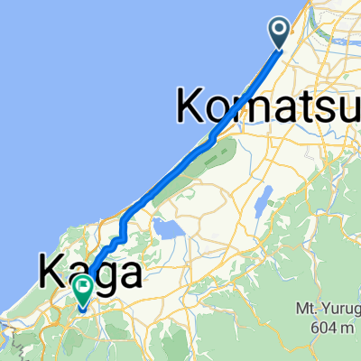
A cycling route starting in Komatsu, Ishikawa, Japan.
Overview
About this route
- -:--
- Duration
- 61.1 km
- Distance
- 1,199 m
- Ascent
- 1,035 m
- Descent
- ---
- Avg. speed
- ---
- Max. altitude

Continue with Bikemap
Use, edit, or download this cycling route
You would like to ride lkh;ll or customize it for your own trip? Here is what you can do with this Bikemap route:
Free features
- Save this route as favorite or in collections
- Copy & plan your own version of this route
- Sync your route with Garmin or Wahoo
Premium features
Free trial for 3 days, or one-time payment. More about Bikemap Premium.
- Navigate this route on iOS & Android
- Export a GPX / KML file of this route
- Create your custom printout (try it for free)
- Download this route for offline navigation
Discover more Premium features.
Get Bikemap PremiumFrom our community
Other popular routes starting in Komatsu
 lkashla
- Distance
- 59.9 km
- Ascent
- 1,114 m
- Descent
- 985 m
- Location
- Komatsu, Ishikawa, Japan

 Ohamamachi Ku, Nomi to Daishojishitayashikimachi, Kaga
- Distance
- 24.2 km
- Ascent
- 134 m
- Descent
- 134 m
- Location
- Komatsu, Ishikawa, Japan
 Recovered Route
- Distance
- 58.8 km
- Ascent
- 0 m
- Descent
- 3 m
- Location
- Komatsu, Ishikawa, Japan
 lkh;ll
- Distance
- 61.1 km
- Ascent
- 1,199 m
- Descent
- 1,035 m
- Location
- Komatsu, Ishikawa, Japan
 百四丈の滝
百四丈の滝- Distance
- 80.1 km
- Ascent
- 888 m
- Descent
- 889 m
- Location
- Komatsu, Ishikawa, Japan
 ニ までヲ
ニ までヲ- Distance
- 23.2 km
- Ascent
- 89 m
- Descent
- 82 m
- Location
- Komatsu, Ishikawa, Japan
 japonia kaga tokio
- Distance
- 612.6 km
- Ascent
- 3,095 m
- Descent
- 3,100 m
- Location
- Komatsu, Ishikawa, Japan
Open it in the app