

Esplad-de-Sèrou
A cycling route starting in Foix, Occitanie, France.
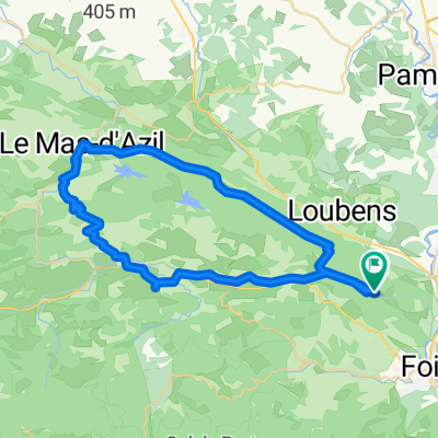
Overview
About this route
- 3 h 22 min
- Duration
- 53.5 km
- Distance
- 1,176 m
- Ascent
- 1,159 m
- Descent
- 15.9 km/h
- Avg. speed
- ---
- Max. altitude

Route photos


Continue with Bikemap
Use, edit, or download this cycling route
You would like to ride Esplad-de-Sèrou or customize it for your own trip? Here is what you can do with this Bikemap route:
Free features
- Save this route as favorite or in collections
- Copy & plan your own version of this route
- Sync your route with Garmin or Wahoo
Premium features
Free trial for 3 days, or one-time payment. More about Bikemap Premium.
- Navigate this route on iOS & Android
- Export a GPX / KML file of this route
- Create your custom printout (try it for free)
- Download this route for offline navigation
Discover more Premium features.
Get Bikemap PremiumFrom our community
Other popular routes starting in Foix
 Bpf 09/11 Train : Foix/Lordat/La Fajolle/ St Hilaire
- Distance
- 272.5 km
- Ascent
- 2,560 m
- Descent
- 2,765 m
- Location
- Foix, Occitanie, France
 2019-06 Foix - Circle to Col de Péguère
- Distance
- 76.9 km
- Ascent
- 1,138 m
- Descent
- 1,137 m
- Location
- Foix, Occitanie, France
 2019-08 Foix to Colomiers (Toulouse)
- Distance
- 85.8 km
- Ascent
- 31 m
- Descent
- 241 m
- Location
- Foix, Occitanie, France
 c2c 2-1
- Distance
- 150.6 km
- Ascent
- 2,567 m
- Descent
- 2,548 m
- Location
- Foix, Occitanie, France
 40k around the Séronais
- Distance
- 40.7 km
- Ascent
- 759 m
- Descent
- 785 m
- Location
- Foix, Occitanie, France
 **16-M. Foix - Gaillac (156 Km)
- Distance
- 155.8 km
- Ascent
- 995 m
- Descent
- 1,284 m
- Location
- Foix, Occitanie, France
 50k Flat To Mas d'Azil
- Distance
- 51.9 km
- Ascent
- 570 m
- Descent
- 578 m
- Location
- Foix, Occitanie, France
 Le Tour De France: Stage 17
- Distance
- 150.7 km
- Ascent
- 3,098 m
- Descent
- 2,843 m
- Location
- Foix, Occitanie, France
Open it in the app