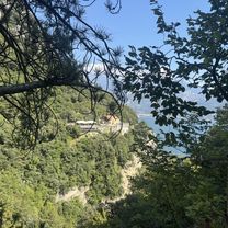
Um den Monte Baldo

A cycling route starting in Torbole sul Garda, Trentino-Alto Adige, Italy.
OverviewAbout this route

Nice route with a few climbs

Translated, show original (German)
-:--
Duration
115.7 km
Distance
456 m
Ascent
454 m
Descent
---
Avg. speed
---
Max. altitude
ihavefuncreated this 7 years ago
Route photos
Photo 1 of the Bikemap route "Um den Monte Baldo"Photo 2 of the Bikemap route "Um den Monte Baldo"
Route qualityWaytypes & surfaces along the route
Waytypes
  • Cycleway

    41.7 km36 %
  • Quiet road

    15 km13 %
  • Path

    6.9 km6 %
Surfaces

Paved

98.4 km(85 %)

Unpaved

3.5 km(3 %)
  • Asphalt

    97.2 km84 %
  • Ground

    2.3 km2 %
  • Concrete

    1.2 km1 %
Continue with BikemapUse, edit, or download this cycling route
You would like to ride Um den Monte Baldo or customize it for your own trip? Here is what you can do with this Bikemap route:
Free features
Premium features

Free trial for 3 days, or one-time payment. More about Bikemap Premium.

  • Navigate this route on iOS & Android
  • Export a GPX / KML file of this route
  • Create your custom printout (try it for free)
  • Download this route for offline navigation

Discover more Premium features.

Get Bikemap Premium
From our communityOther popular routes starting in Torbole sul Garda

Open it in the app