

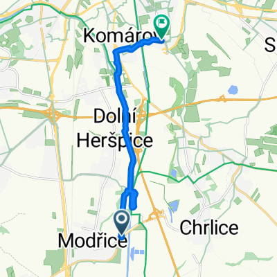
Olympie 24.11.2018
A cycling route starting in Modřice, South Moravian, Czechia.
Overview
About this route
Olympie 24.11.2018
- -:--
- Duration
- 47.2 km
- Distance
- 164 m
- Ascent
- 127 m
- Descent
- ---
- Avg. speed
- ---
- Max. altitude

Route quality
Waytypes & surfaces along the route
Waytypes
Road
21.7 km
(46 %)
Quiet road
2.8 km
(6 %)
Surfaces
Paved
32.1 km
(68 %)
Unpaved
0.9 km
(2 %)
Asphalt
32.1 km
(68 %)
Gravel
0.9 km
(2 %)
Undefined
14.1 km
(30 %)
Continue with Bikemap
Use, edit, or download this cycling route
You would like to ride Olympie 24.11.2018 or customize it for your own trip? Here is what you can do with this Bikemap route:
Free features
- Save this route as favorite or in collections
- Copy & plan your own version of this route
- Sync your route with Garmin or Wahoo
Premium features
Free trial for 3 days, or one-time payment. More about Bikemap Premium.
- Navigate this route on iOS & Android
- Export a GPX / KML file of this route
- Create your custom printout (try it for free)
- Download this route for offline navigation
Discover more Premium features.
Get Bikemap PremiumFrom our community
Other popular routes starting in Modřice
 Brusle
- Distance
- 10 km
- Ascent
- 23 m
- Descent
- 13 m
- Location
- Modřice, South Moravian, Czechia
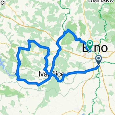 2.4.2011 - Olympie (Brno-Bites-Brno)
- Distance
- 124.6 km
- Ascent
- 813 m
- Descent
- 795 m
- Location
- Modřice, South Moravian, Czechia
 02.11.2008 - Olympie a 18.1.2009
- Distance
- 56.8 km
- Ascent
- 288 m
- Descent
- 281 m
- Location
- Modřice, South Moravian, Czechia
 Po stopách Napoleona Bonaparte
- Distance
- 74.2 km
- Ascent
- 460 m
- Descent
- 460 m
- Location
- Modřice, South Moravian, Czechia
 Modřice-Měnín,MTB ride
- Distance
- 32.7 km
- Ascent
- 104 m
- Descent
- 111 m
- Location
- Modřice, South Moravian, Czechia
 23.12.2007 Olympie
- Distance
- 58.6 km
- Ascent
- 230 m
- Descent
- 220 m
- Location
- Modřice, South Moravian, Czechia
 Olympia - Blučina - Rajhrad - Olympia
- Distance
- 27.9 km
- Ascent
- 105 m
- Descent
- 104 m
- Location
- Modřice, South Moravian, Czechia
 Recording from 1. června 14:44
- Distance
- 16.9 km
- Ascent
- 64 m
- Descent
- 70 m
- Location
- Modřice, South Moravian, Czechia
Open it in the app