

opcion 1 -b
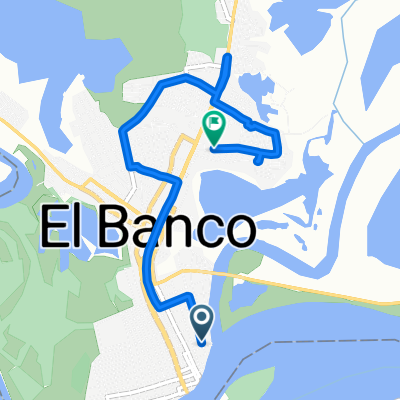
A cycling route starting in El Banco, Magdalena Department, Colombia.
Overview
About this route
- -:--
- Duration
- 634.4 km
- Distance
- 484 m
- Ascent
- 505 m
- Descent
- ---
- Avg. speed
- ---
- Max. altitude
Continue with Bikemap
Use, edit, or download this cycling route
You would like to ride opcion 1 -b or customize it for your own trip? Here is what you can do with this Bikemap route:
Free features
- Save this route as favorite or in collections
- Copy & plan your own version of this route
- Split it into stages to create a multi-day tour
- Sync your route with Garmin or Wahoo
Premium features
Free trial for 3 days, or one-time payment. More about Bikemap Premium.
- Navigate this route on iOS & Android
- Export a GPX / KML file of this route
- Create your custom printout (try it for free)
- Download this route for offline navigation
Discover more Premium features.
Get Bikemap PremiumFrom our community
Other popular routes starting in El Banco
 oneruns
- Distance
- 7 km
- Ascent
- 81 m
- Descent
- 87 m
- Location
- El Banco, Magdalena Department, Colombia
 el banco to cartagena
- Distance
- 773.7 km
- Ascent
- 616 m
- Descent
- 622 m
- Location
- El Banco, Magdalena Department, Colombia
 19 etapa El Banco - Mompos
- Distance
- 70.2 km
- Ascent
- 24 m
- Descent
- 37 m
- Location
- El Banco, Magdalena Department, Colombia
 el banco to punta gallinas
- Distance
- 949.8 km
- Ascent
- 559 m
- Descent
- 577 m
- Location
- El Banco, Magdalena Department, Colombia
 opcion 1 -b
- Distance
- 634.4 km
- Ascent
- 484 m
- Descent
- 505 m
- Location
- El Banco, Magdalena Department, Colombia
 Paseo intenso en Río Viejo
- Distance
- 11.2 km
- Ascent
- 444 m
- Descent
- 439 m
- Location
- El Banco, Magdalena Department, Colombia
 Ruta tranquila en Río Viejo
- Distance
- 13.2 km
- Ascent
- 104 m
- Descent
- 136 m
- Location
- El Banco, Magdalena Department, Colombia
 De Carrera 24 a Carrera 24
- Distance
- 35.3 km
- Ascent
- 338 m
- Descent
- 343 m
- Location
- El Banco, Magdalena Department, Colombia
Open it in the app