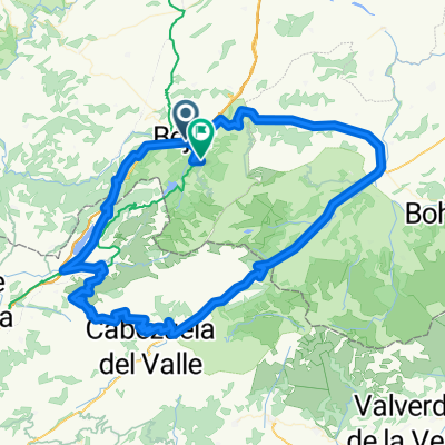
Vía verde de Béjar y valle del Ambroz
A cycling route starting in Béjar, Castille and León, Spain.
Overview
About this route
Vía verde de Béjar y valle del Ambroz
- -:--
- Duration
- 86.2 km
- Distance
- 1,056 m
- Ascent
- 1,058 m
- Descent
- ---
- Avg. speed
- ---
- Avg. speed
Continue with Bikemap
Use, edit, or download this cycling route
You would like to ride Vía verde de Béjar y valle del Ambroz or customize it for your own trip? Here is what you can do with this Bikemap route:
Free features
- Save this route as favorite or in collections
- Copy & plan your own version of this route
- Sync your route with Garmin or Wahoo
Premium features
Free trial for 3 days, or one-time payment. More about Bikemap Premium.
- Navigate this route on iOS & Android
- Export a GPX / KML file of this route
- Create your custom printout (try it for free)
- Download this route for offline navigation
Discover more Premium features.
Get Bikemap PremiumFrom our community
Other popular routes starting in Béjar
- Béjar 1
- Distance
- 82.2 km
- Ascent
- 2,185 m
- Descent
- 2,174 m
- Location
- Béjar, Castille and León, Spain
- BÉJAR - LA ALBERCA
- Distance
- 68.4 km
- Ascent
- 1,652 m
- Descent
- 1,457 m
- Location
- Béjar, Castille and León, Spain
- Extramadura-03: Bejar - La Alberca
- Distance
- 46.9 km
- Ascent
- 923 m
- Descent
- 821 m
- Location
- Béjar, Castille and León, Spain
- Béjar- Ruta Heidi y Vía Verde
- Distance
- 77.6 km
- Ascent
- 1,425 m
- Descent
- 1,421 m
- Location
- Béjar, Castille and León, Spain
- Béjar - Presa Navamuño - Cancho de la Muela - Candelario - Alto de los Pollos - Béjar
- Distance
- 34.9 km
- Ascent
- 699 m
- Descent
- 700 m
- Location
- Béjar, Castille and León, Spain
- Béjar - Baños de Montemayor - La Garganta - Candelario - Béjar
- Distance
- 37.2 km
- Ascent
- 741 m
- Descent
- 741 m
- Location
- Béjar, Castille and León, Spain
- Bejar-Peña de Francia
- Distance
- 68.2 km
- Ascent
- 1,463 m
- Descent
- 774 m
- Location
- Béjar, Castille and León, Spain
- Béjar - Los Pinos - Candelario - Cancho la Muela - Llano Alto - Béjar
- Distance
- 32.2 km
- Ascent
- 742 m
- Descent
- 727 m
- Location
- Béjar, Castille and León, Spain
Open it in the app