

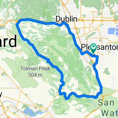
Palomares
A cycling route starting in Pleasanton, California, United States.
Overview
About this route
- -:--
- Duration
- 47.9 km
- Distance
- 494 m
- Ascent
- 491 m
- Descent
- ---
- Avg. speed
- ---
- Max. altitude

Route quality
Waytypes & surfaces along the route
Waytypes
Road
18.2 km
(38 %)
Quiet road
1 km
(2 %)
Undefined
28.8 km
(60 %)
Surfaces
Paved
19.2 km
(40 %)
Asphalt
12.5 km
(26 %)
Paved (undefined)
6.2 km
(13 %)
Continue with Bikemap
Use, edit, or download this cycling route
You would like to ride Palomares or customize it for your own trip? Here is what you can do with this Bikemap route:
Free features
- Save this route as favorite or in collections
- Copy & plan your own version of this route
- Sync your route with Garmin or Wahoo
Premium features
Free trial for 3 days, or one-time payment. More about Bikemap Premium.
- Navigate this route on iOS & Android
- Export a GPX / KML file of this route
- Create your custom printout (try it for free)
- Download this route for offline navigation
Discover more Premium features.
Get Bikemap PremiumFrom our community
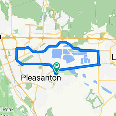
Other popular routes starting in Pleasanton
 Blistering ride in Pleasanton
- Distance
- 63.4 km
- Ascent
- 255 m
- Descent
- 266 m
- Location
- Pleasanton, California, United States
 Morgan Territory and Vasco
- Distance
- 114 km
- Ascent
- 950 m
- Descent
- 950 m
- Location
- Pleasanton, California, United States
 High-speed route in Pleasanton
- Distance
- 68.3 km
- Ascent
- 431 m
- Descent
- 438 m
- Location
- Pleasanton, California, United States
 Pleasanton - San Ramon Hills - Bernal
- Distance
- 36 km
- Ascent
- 350 m
- Descent
- 348 m
- Location
- Pleasanton, California, United States
 CS Ironman 70.3
- Distance
- 45 km
- Ascent
- 180 m
- Descent
- 180 m
- Location
- Pleasanton, California, United States
 Palomares
- Distance
- 47.9 km
- Ascent
- 494 m
- Descent
- 491 m
- Location
- Pleasanton, California, United States
 Cracking ride in Pleasanton
- Distance
- 38.6 km
- Ascent
- 241 m
- Descent
- 240 m
- Location
- Pleasanton, California, United States
 60 Vintage Cir, Pleasanton to 60 Vintage Cir, Pleasanton
- Distance
- 22.7 km
- Ascent
- 67 m
- Descent
- 69 m
- Location
- Pleasanton, California, United States
Open it in the app