

norwegia
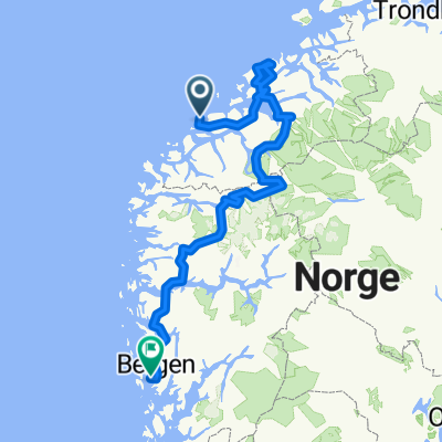
A cycling route starting in Valderøy, Møre og Romsdal, Norway.
Overview
About this route
- -:--
- Duration
- 779.7 km
- Distance
- 3,962 m
- Ascent
- 3,930 m
- Descent
- ---
- Avg. speed
- ---
- Max. altitude
Route highlights
Points of interest along the route
Point of interest after 0 km
Alesund
Point of interest after 172.6 km
Droga Atlantycka https://www.norwegofil.pl/norwegia-zachodnia/droga-atlantycka
Point of interest after 278.1 km
Trondhaim 33 km od lotniska
Point of interest after 298.5 km
Droga Troli https://www.norwegofil.pl/norwegia-zachodnia/zloty-szlak-geiranger-trollstigen
Point of interest after 355.8 km
Droga Orła z Eidsdal do Geiranger
Point of interest after 355.8 km
Wodospad Siedem Sióstr
Point of interest after 441.7 km
https://www.norwegofil.pl/najpiekniejsze-trasy/stara-droga-przez-strynefjell
Point of interest after 448.8 km
Koniec drogi rowerowej kolejowej z Flam. Finse Flam 51 km
Point of interest after 448.8 km
https://www.norwegofil.pl/najpiekniejsze-trasy/sniezna-droga-aurlandsvegen Aurland-Laerdal
Point of interest after 494.2 km
10. Briksdal: niesamowity lodowiec Briksadal to jęzor lodowca Josteda (największego w Europie kontynentalnej) kaskadowo schodzący do leżącego u jego podnóża jeziora. Aby zobaczyć to miejsce, trzeba rozpocząć około 45-minutową wędrówkę z miejscowości Olden. Do lodowca można podejść na kilkadziesiąt metrów – z tej odległości słychać już hurgot odrywających się od niego fragmentów lodu. Więcej: https://www.radiozet.pl/Podroze-Radia-ZET/Chcesz-zwiedzic-Norwegie-Oto-10-miejsc-ktore-trzeba-zobaczyc
Point of interest after 550.7 km
https://www.norwegofil.pl/najpiekniejsze-trasy/rowerowy-szlak-rallarvegen
Point of interest after 550.7 km
Jedną z najbardziej znanych tras rowerowych w kraju jest malownicza górska droga Rallarvegen (Droga Kolejowa). Strome zjazdy i dzikie wodospady czynią tę drogę wyjątkową, przez co wybrana została najlepszą trasą rowerową w Norwegii przez magazyn ‘Travel and Vacation’.
Point of interest after 551.9 km
Stalheimsklevia- najbardziej stromy zjazd. Można jechać tylko w dół. https://www.norwegofil.pl/najpiekniejsze-trasy/droga-stalheimskleiva
Point of interest after 717.5 km
Trolltunga język trola
Point of interest after 771.9 km
Kjerag zaklinowany kamień
Point of interest after 771.9 km
Parking do wejścia na zakleszczony kamień.
Point of interest after 771.9 km
Preikestolen kostka 25x25 m
Point of interest after 772.4 km
Stavanger lotnisko
Point of interest after 776.8 km
Haugesund lotnisko
Point of interest after 779.7 km
Bergen lotnisko
Continue with Bikemap
Use, edit, or download this cycling route
You would like to ride norwegia or customize it for your own trip? Here is what you can do with this Bikemap route:
Free features
- Save this route as favorite or in collections
- Copy & plan your own version of this route
- Split it into stages to create a multi-day tour
- Sync your route with Garmin or Wahoo
Premium features
Free trial for 3 days, or one-time payment. More about Bikemap Premium.
- Navigate this route on iOS & Android
- Export a GPX / KML file of this route
- Create your custom printout (try it for free)
- Download this route for offline navigation
Discover more Premium features.
Get Bikemap PremiumFrom our community
Other popular routes starting in Valderøy
 De Hamnsundkleiva 3 à Strandgata 1
- Distance
- 19.5 km
- Ascent
- 284 m
- Descent
- 297 m
- Location
- Valderøy, Møre og Romsdal, Norway
 Steady ride in Ellingsøy
- Distance
- 15.2 km
- Ascent
- 681 m
- Descent
- 747 m
- Location
- Valderøy, Møre og Romsdal, Norway
 norwegia
- Distance
- 779.7 km
- Ascent
- 3,962 m
- Descent
- 3,930 m
- Location
- Valderøy, Møre og Romsdal, Norway
 giske
giske- Distance
- 7.7 km
- Ascent
- 9 m
- Descent
- 9 m
- Location
- Valderøy, Møre og Romsdal, Norway
 ALESUND-KRISTIANSUND-GEIRANGER-ALESUND
- Distance
- 515.4 km
- Ascent
- 3,155 m
- Descent
- 3,159 m
- Location
- Valderøy, Møre og Romsdal, Norway
 lotniksko - centrum alesund
- Distance
- 17.6 km
- Ascent
- 387 m
- Descent
- 389 m
- Location
- Valderøy, Møre og Romsdal, Norway
 Etappe 8 Ålesund (ferry Hamnsund - Molde
- Distance
- 67 km
- Ascent
- 303 m
- Descent
- 305 m
- Location
- Valderøy, Møre og Romsdal, Norway
 Primær Fylkesveg 658 do Alnesvegen 4
- Distance
- 7.7 km
- Ascent
- 104 m
- Descent
- 119 m
- Location
- Valderøy, Møre og Romsdal, Norway
Open it in the app