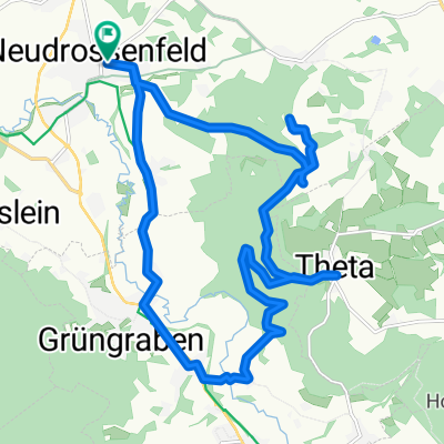
Rund um Thurau durch schöne Täler
A cycling route starting in Neudrossenfeld, Bavaria, Germany.
Overview
About this route
- -:--
- Duration
- 53.5 km
- Distance
- 458 m
- Ascent
- 462 m
- Descent
- ---
- Avg. speed
- ---
- Avg. speed
Route photos
Route quality
Waytypes & surfaces along the route
Waytypes
Track
20.2 km
(38 %)
Quiet road
14 km
(26 %)
Surfaces
Paved
18.8 km
(35 %)
Unpaved
15.1 km
(28 %)
Asphalt
15.7 km
(29 %)
Gravel
10.2 km
(19 %)
Continue with Bikemap
Use, edit, or download this cycling route
You would like to ride Rund um Thurau durch schöne Täler or customize it for your own trip? Here is what you can do with this Bikemap route:
Free features
- Save this route as favorite or in collections
- Copy & plan your own version of this route
- Sync your route with Garmin or Wahoo
Premium features
Free trial for 3 days, or one-time payment. More about Bikemap Premium.
- Navigate this route on iOS & Android
- Export a GPX / KML file of this route
- Create your custom printout (try it for free)
- Download this route for offline navigation
Discover more Premium features.
Get Bikemap PremiumFrom our community
Other popular routes starting in Neudrossenfeld
- Rund um Thurau durch schöne Täler
- Distance
- 53.5 km
- Ascent
- 458 m
- Descent
- 462 m
- Location
- Neudrossenfeld, Bavaria, Germany
- Limmersdorfer Forst Runde ab Neudrossenfeld
- Distance
- 32.4 km
- Ascent
- 344 m
- Descent
- 344 m
- Location
- Neudrossenfeld, Bavaria, Germany
- Neuenreut-Limmersdorf
- Distance
- 16.8 km
- Ascent
- 249 m
- Descent
- 237 m
- Location
- Neudrossenfeld, Bavaria, Germany
- Lochautal Runde von Neudrossenfeld
- Distance
- 50.4 km
- Ascent
- 593 m
- Descent
- 569 m
- Location
- Neudrossenfeld, Bavaria, Germany
- Über den Görauer Anger am Main entlang
- Distance
- 50.6 km
- Ascent
- 321 m
- Descent
- 320 m
- Location
- Neudrossenfeld, Bavaria, Germany
- Feierabendrunde von Neudrossenfeld in den Sonnenuntergang
- Distance
- 32.4 km
- Ascent
- 388 m
- Descent
- 397 m
- Location
- Neudrossenfeld, Bavaria, Germany
- sandgrube 1
- Distance
- 18.9 km
- Ascent
- 263 m
- Descent
- 263 m
- Location
- Neudrossenfeld, Bavaria, Germany
- Rotmaintal und Trebgasttal
- Distance
- 40.7 km
- Ascent
- 382 m
- Descent
- 375 m
- Location
- Neudrossenfeld, Bavaria, Germany
Open it in the app