

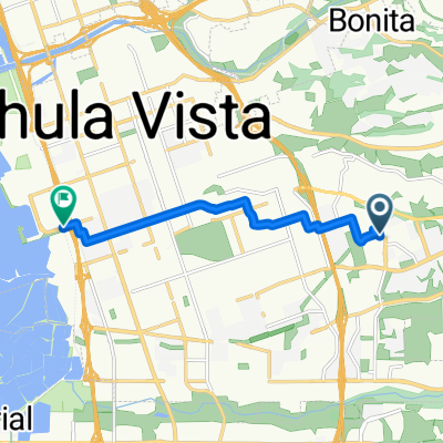
8.5 Mile Loop
A cycling route starting in Bonita, California, United States.
Overview
About this route
- -:--
- Duration
- 13.5 km
- Distance
- 194 m
- Ascent
- 194 m
- Descent
- ---
- Avg. speed
- ---
- Max. altitude
Route quality
Waytypes & surfaces along the route
Waytypes
Road
7.2 km
(53 %)
Access road
0.8 km
(6 %)
Surfaces
Paved
10.3 km
(76 %)
Asphalt
10.3 km
(76 %)
Undefined
3.2 km
(24 %)
Continue with Bikemap
Use, edit, or download this cycling route
You would like to ride 8.5 Mile Loop or customize it for your own trip? Here is what you can do with this Bikemap route:
Free features
- Save this route as favorite or in collections
- Copy & plan your own version of this route
- Sync your route with Garmin or Wahoo
Premium features
Free trial for 3 days, or one-time payment. More about Bikemap Premium.
- Navigate this route on iOS & Android
- Export a GPX / KML file of this route
- Create your custom printout (try it for free)
- Download this route for offline navigation
Discover more Premium features.
Get Bikemap PremiumFrom our community
Other popular routes starting in Bonita
 125 La Media Loop
- Distance
- 19.8 km
- Ascent
- 290 m
- Descent
- 288 m
- Location
- Bonita, California, United States
 1545 Bath Ave, Chula Vista to 1475 Lake Crest Dr, Chula Vista
- Distance
- 10.8 km
- Ascent
- 174 m
- Descent
- 143 m
- Location
- Bonita, California, United States
 Route to Chula Vista
- Distance
- 8.3 km
- Ascent
- 25 m
- Descent
- 117 m
- Location
- Bonita, California, United States
 Cielo Circulo 2957, Chula Vista to Cielo Circulo 2957, Chula Vista
- Distance
- 16.8 km
- Ascent
- 90 m
- Descent
- 108 m
- Location
- Bonita, California, United States
 1529 Bath Ave, Chula Vista to 1545 Bath Ave, Chula Vista
- Distance
- 23.9 km
- Ascent
- 285 m
- Descent
- 285 m
- Location
- Bonita, California, United States
 Crescent Drive 667, Chula Vista to Crescent Drive 671, Chula Vista
- Distance
- 12.3 km
- Ascent
- 211 m
- Descent
- 222 m
- Location
- Bonita, California, United States
 Wueste Road 2048, Chula Vista to Paseo Ranchero 1206, Chula Vista
- Distance
- 28.2 km
- Ascent
- 164 m
- Descent
- 191 m
- Location
- Bonita, California, United States
 Otay lakes-Honey Spring-Skyline-Otay Lakes
- Distance
- 81.3 km
- Ascent
- 1,275 m
- Descent
- 1,275 m
- Location
- Bonita, California, United States
Open it in the app