

Pollionnay - La Bleue : Trace initiatique
A cycling route starting in Pollionnay, Auvergne-Rhône-Alpes, France.
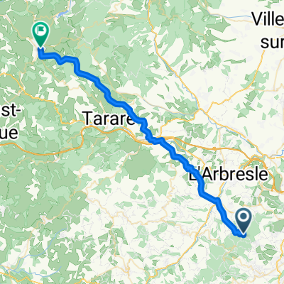
Overview
About this route
- -:--
- Duration
- 14.2 km
- Distance
- 430 m
- Ascent
- 426 m
- Descent
- ---
- Avg. speed
- ---
- Max. altitude

Route quality
Waytypes & surfaces along the route
Waytypes
Track
6.2 km
(44 %)
Quiet road
3.4 km
(24 %)
Surfaces
Paved
2.6 km
(18 %)
Unpaved
7.1 km
(50 %)
Ground
6 km
(42 %)
Asphalt
2.6 km
(18 %)
Continue with Bikemap
Use, edit, or download this cycling route
You would like to ride Pollionnay - La Bleue : Trace initiatique or customize it for your own trip? Here is what you can do with this Bikemap route:
Free features
- Save this route as favorite or in collections
- Copy & plan your own version of this route
- Sync your route with Garmin or Wahoo
Premium features
Free trial for 3 days, or one-time payment. More about Bikemap Premium.
- Navigate this route on iOS & Android
- Export a GPX / KML file of this route
- Create your custom printout (try it for free)
- Download this route for offline navigation
Discover more Premium features.
Get Bikemap PremiumFrom our community
Other popular routes starting in Pollionnay
 Pollionnay - La Bleue : Trace initiatique
- Distance
- 14.2 km
- Ascent
- 430 m
- Descent
- 426 m
- Location
- Pollionnay, Auvergne-Rhône-Alpes, France
 Pollionnay - Amplepuis
- Distance
- 40.8 km
- Ascent
- 1,110 m
- Descent
- 1,286 m
- Location
- Pollionnay, Auvergne-Rhône-Alpes, France
 Les 5 DH Enduro de Pollionnay
- Distance
- 27.7 km
- Ascent
- 935 m
- Descent
- 935 m
- Location
- Pollionnay, Auvergne-Rhône-Alpes, France
 Mont du Lyonnais
- Distance
- 58.7 km
- Ascent
- 1,528 m
- Descent
- 1,528 m
- Location
- Pollionnay, Auvergne-Rhône-Alpes, France
 circuit bleu VTT pollyo
- Distance
- 14.5 km
- Ascent
- 488 m
- Descent
- 478 m
- Location
- Pollionnay, Auvergne-Rhône-Alpes, France
 Crêt du Lac : Entre Luère et Malatray
- Distance
- 18.3 km
- Ascent
- 639 m
- Descent
- 634 m
- Location
- Pollionnay, Auvergne-Rhône-Alpes, France
 Track 23
- Distance
- 15.6 km
- Ascent
- 0 m
- Descent
- 0 m
- Location
- Pollionnay, Auvergne-Rhône-Alpes, France
 Circuit VTT Pollyo Rouge
- Distance
- 49.2 km
- Ascent
- 2,190 m
- Descent
- 2,193 m
- Location
- Pollionnay, Auvergne-Rhône-Alpes, France
Open it in the app