15km medium
- 15.8 km
- 145 m
- 145 m
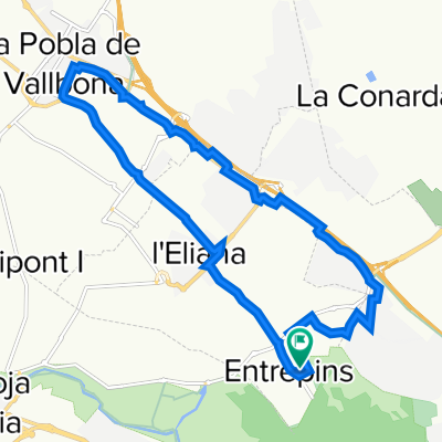
- L'Eliana, Valencia, Spain
A cycling route starting in L'Eliana, Valencia, Spain.
Overview
Up to the base of Calderona mostly paved on orchard paths. The climb to Calderona is long but along wide paths. The ascent is on a path with not much gradient that at one point offers a cool view of the Porta Coeli monastery. The descent, via Font del Berro and Font de la Gota, is a rollercoaster with practically no climbs; very nice.
created this 15 years ago
Route highlights
Vistes al monestir de Porta Coeli. S'ha d'eixir un poc de la ruta.
Punt més alt de la ruta
Secció un poc trialera però molt curteta.
Continue with Bikemap
You would like to ride L'Eliana-Font del Berro-Font de la Gota-L'Eliana or customize it for your own trip? Here is what you can do with this Bikemap route:
Free trial for 3 days, or one-time payment. More about Bikemap Premium.
Discover more Premium features.
Get Bikemap PremiumFrom our community
Open it in the app