

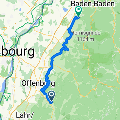
2019_Teil1_AH_Tour
A cycling route starting in Gengenbach, Hesse, Germany.
Overview
About this route
Fast ausschließlich geteerte Wege. Anfangs abwechselnd durch kleine Orte und Obstfelder. Die Rheinüberquerung ist beeindruckend. Die kleine Fähre Drusen ist ganz nett zu benzuten.
- -:--
- Duration
- 98.4 km
- Distance
- 181 m
- Ascent
- 230 m
- Descent
- ---
- Avg. speed
- ---
- Max. altitude

Route quality
Waytypes & surfaces along the route
Waytypes
Quiet road
44.3 km
(45 %)
Track
18.7 km
(19 %)
Surfaces
Paved
87.6 km
(89 %)
Unpaved
1 km
(1 %)
Asphalt
80.7 km
(82 %)
Paved (undefined)
5.9 km
(6 %)
Route highlights
Points of interest along the route
Drinking water after 38.8 km
REWE Supermarkt
Accommodation after 47.4 km
Platz.Hirsch_Restaurant
Drinking water after 71.9 km
Port de Plaisance
Continue with Bikemap
Use, edit, or download this cycling route
You would like to ride 2019_Teil1_AH_Tour or customize it for your own trip? Here is what you can do with this Bikemap route:
Free features
- Save this route as favorite or in collections
- Copy & plan your own version of this route
- Split it into stages to create a multi-day tour
- Sync your route with Garmin or Wahoo
Premium features
Free trial for 3 days, or one-time payment. More about Bikemap Premium.
- Navigate this route on iOS & Android
- Export a GPX / KML file of this route
- Create your custom printout (try it for free)
- Download this route for offline navigation
Discover more Premium features.
Get Bikemap PremiumFrom our community
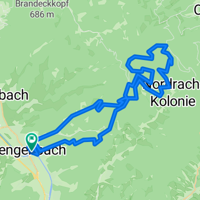
Other popular routes starting in Gengenbach
 Ausfahrt durch Steinach im Kinzigtal
- Distance
- 14.3 km
- Ascent
- 54 m
- Descent
- 28 m
- Location
- Gengenbach, Hesse, Germany
 Gengenbach - Haigerach - Emsbach - Pfaffenbach - Gengenbach (Klinik)
- Distance
- 15.1 km
- Ascent
- 538 m
- Descent
- 538 m
- Location
- Gengenbach, Hesse, Germany
 3. Etappe von Gengenbach nach Bühl
- Distance
- 58.7 km
- Ascent
- 683 m
- Descent
- 695 m
- Location
- Gengenbach, Hesse, Germany
 7-Täler-Weg Gengenbach nach Biberach CLONED FROM ROUTE 1607693
- Distance
- 18.5 km
- Ascent
- 517 m
- Descent
- 495 m
- Location
- Gengenbach, Hesse, Germany
 Gengenbach-Offenburg-Schutterzell-Niederschopfheim-Zunsweier-Gengenbach
- Distance
- 54.2 km
- Ascent
- 89 m
- Descent
- 87 m
- Location
- Gengenbach, Hesse, Germany
 Kornbebene, Moos (MTB)
- Distance
- 26.9 km
- Ascent
- 705 m
- Descent
- 704 m
- Location
- Gengenbach, Hesse, Germany
 Kornebene - Lothardenkmal-Nordrach
- Distance
- 35.7 km
- Ascent
- 1,224 m
- Descent
- 1,109 m
- Location
- Gengenbach, Hesse, Germany
 Von Gengenbach über Kornebene nach Steinenbach und zurück
- Distance
- 42.3 km
- Ascent
- 1,249 m
- Descent
- 1,257 m
- Location
- Gengenbach, Hesse, Germany
Open it in the app