

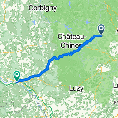
Le Morvandiau
A cycling route starting in Autun, Bourgogne-Franche-Comté, France.
Overview
About this route
This guide describes the route of the 'Le Morvandiau' race organized by the Autun cycling club. The interesting aspect of this route is that it takes place almost exclusively in the woods (less than 10% on roads). Alternating between wide, fast trails and more technical paths.
No particular difficulties for those accustomed to this distance.
A few technical descents (2) that less experienced riders will walk down.
No carrying of the bike required. One or two push sections depending on physical condition.
For information, the winner of the 2006 edition completed this route in 1h45.
It is not uncommon to find snow on this route until spring. The terrain is rather muddy except in summer.
- -:--
- Duration
- 39.7 km
- Distance
- 696 m
- Ascent
- 696 m
- Descent
- ---
- Avg. speed
- ---
- Max. altitude

Route quality
Waytypes & surfaces along the route
Waytypes
Track
22.6 km
(57 %)
Quiet road
6.4 km
(16 %)
Surfaces
Paved
1.6 km
(4 %)
Unpaved
2.8 km
(7 %)
Asphalt
1.6 km
(4 %)
Unpaved (undefined)
0.8 km
(2 %)
Continue with Bikemap
Use, edit, or download this cycling route
You would like to ride Le Morvandiau or customize it for your own trip? Here is what you can do with this Bikemap route:
Free features
- Save this route as favorite or in collections
- Copy & plan your own version of this route
- Sync your route with Garmin or Wahoo
Premium features
Free trial for 3 days, or one-time payment. More about Bikemap Premium.
- Navigate this route on iOS & Android
- Export a GPX / KML file of this route
- Create your custom printout (try it for free)
- Download this route for offline navigation
Discover more Premium features.
Get Bikemap PremiumFrom our community
Other popular routes starting in Autun
 Le Morvandiau
- Distance
- 39.7 km
- Ascent
- 696 m
- Descent
- 696 m
- Location
- Autun, Bourgogne-Franche-Comté, France
 Autun
Autun- Distance
- 18.6 km
- Ascent
- 425 m
- Descent
- 422 m
- Location
- Autun, Bourgogne-Franche-Comté, France
 Autun - Decize
- Distance
- 80.5 km
- Ascent
- 1,048 m
- Descent
- 1,311 m
- Location
- Autun, Bourgogne-Franche-Comté, France
 From Autun to Château-Chinon (Ville)
- Distance
- 36.6 km
- Ascent
- 788 m
- Descent
- 552 m
- Location
- Autun, Bourgogne-Franche-Comté, France
 Day 6: Autun to Beaune
- Distance
- 56 km
- Ascent
- 505 m
- Descent
- 578 m
- Location
- Autun, Bourgogne-Franche-Comté, France
 Sortie Autun 26/03/2016 125km
- Distance
- 125.6 km
- Ascent
- 1,191 m
- Descent
- 1,193 m
- Location
- Autun, Bourgogne-Franche-Comté, France
 Autun
Autun- Distance
- 18.7 km
- Ascent
- 434 m
- Descent
- 431 m
- Location
- Autun, Bourgogne-Franche-Comté, France
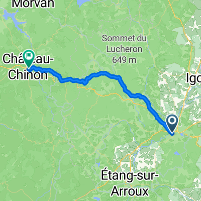 From Autun to Château-Chinon (Ville)
- Distance
- 37.7 km
- Ascent
- 724 m
- Descent
- 488 m
- Location
- Autun, Bourgogne-Franche-Comté, France
Open it in the app