

steinbachtalsperre
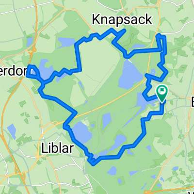
A cycling route starting in Brühl, North Rhine-Westphalia, Germany.
Overview
About this route
pingsdorf-weilerswist-derkum-lommersum-kessenich-elsig-wißkirchen-billig-kreuzweingarten-kirspenich-arloff-steinbachtalsperre-kirchheim-flamersheim-palmersheim-odendorf-essig-ludendorf-ollheim-heimerzheim-metternich-rösberg-sechtem-schwadorf
- -:--
- Duration
- 74.5 km
- Distance
- 354 m
- Ascent
- 369 m
- Descent
- ---
- Avg. speed
- ---
- Avg. speed

Route quality
Waytypes & surfaces along the route
Waytypes
Road
26.5 km
(36 %)
Busy road
19.9 km
(27 %)
Surfaces
Paved
61.9 km
(83 %)
Unpaved
0 km
(<1 %)
Asphalt
61 km
(82 %)
Paved (undefined)
0.9 km
(1 %)
Continue with Bikemap
Use, edit, or download this cycling route
You would like to ride steinbachtalsperre or customize it for your own trip? Here is what you can do with this Bikemap route:
Free features
- Save this route as favorite or in collections
- Copy & plan your own version of this route
- Sync your route with Garmin or Wahoo
Premium features
Free trial for 3 days, or one-time payment. More about Bikemap Premium.
- Navigate this route on iOS & Android
- Export a GPX / KML file of this route
- Create your custom printout (try it for free)
- Download this route for offline navigation
Discover more Premium features.
Get Bikemap PremiumFrom our community
Other popular routes starting in Brühl
 Route nach Aachen
- Distance
- 84.1 km
- Ascent
- 355 m
- Descent
- 246 m
- Location
- Brühl, North Rhine-Westphalia, Germany
 Große Runde ab Brühl
- Distance
- 48.4 km
- Ascent
- 299 m
- Descent
- 299 m
- Location
- Brühl, North Rhine-Westphalia, Germany
 Seenweg Brühl
- Distance
- 20.8 km
- Ascent
- 91 m
- Descent
- 94 m
- Location
- Brühl, North Rhine-Westphalia, Germany
 Brühl - Bonn
- Distance
- 48.9 km
- Ascent
- 100 m
- Descent
- 108 m
- Location
- Brühl, North Rhine-Westphalia, Germany
 MTB: Best of Ville
- Distance
- 40.5 km
- Ascent
- 214 m
- Descent
- 214 m
- Location
- Brühl, North Rhine-Westphalia, Germany
 um ein Paar Seen
- Distance
- 27.5 km
- Ascent
- 169 m
- Descent
- 168 m
- Location
- Brühl, North Rhine-Westphalia, Germany
 Rund um Brühl, Schlösser und Felder
- Distance
- 15.9 km
- Ascent
- 26 m
- Descent
- 22 m
- Location
- Brühl, North Rhine-Westphalia, Germany
 BrühlKottenforst60
- Distance
- 59.8 km
- Ascent
- 325 m
- Descent
- 326 m
- Location
- Brühl, North Rhine-Westphalia, Germany
Open it in the app