

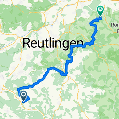
Jungingen - Großheide
A cycling route starting in Jungingen, Baden-Wurttemberg, Germany.
Overview
About this route
- -:--
- Duration
- 725.9 km
- Distance
- 990 m
- Ascent
- 1,576 m
- Descent
- ---
- Avg. speed
- ---
- Max. altitude

Route quality
Waytypes & surfaces along the route
Waytypes
Path
181.5 km
(25 %)
Quiet road
174.2 km
(24 %)
Surfaces
Paved
609.8 km
(84 %)
Unpaved
29 km
(4 %)
Asphalt
573.5 km
(79 %)
Paved (undefined)
21.8 km
(3 %)
Continue with Bikemap
Use, edit, or download this cycling route
You would like to ride Jungingen - Großheide or customize it for your own trip? Here is what you can do with this Bikemap route:
Free features
- Save this route as favorite or in collections
- Copy & plan your own version of this route
- Split it into stages to create a multi-day tour
- Sync your route with Garmin or Wahoo
Premium features
Free trial for 3 days, or one-time payment. More about Bikemap Premium.
- Navigate this route on iOS & Android
- Export a GPX / KML file of this route
- Create your custom printout (try it for free)
- Download this route for offline navigation
Discover more Premium features.
Get Bikemap PremiumFrom our community
Other popular routes starting in Jungingen
 Day 3 Trans Germany
- Distance
- 78 km
- Ascent
- 812 m
- Descent
- 1,101 m
- Location
- Jungingen, Baden-Wurttemberg, Germany
 Schnelle Ausfahrt von Hechingen nach Mössingen
- Distance
- 8.6 km
- Ascent
- 65 m
- Descent
- 284 m
- Location
- Jungingen, Baden-Wurttemberg, Germany
 Schömberg
- Distance
- 34.3 km
- Ascent
- 320 m
- Descent
- 202 m
- Location
- Jungingen, Baden-Wurttemberg, Germany
 Salmend-Gögg-Laiz-Mühlh.
- Distance
- 98 km
- Ascent
- 604 m
- Descent
- 957 m
- Location
- Jungingen, Baden-Wurttemberg, Germany
 20150725 Tour de Nägelehaus - Tag 2 - gefahrene korrigierte Finale Version
- Distance
- 89.4 km
- Ascent
- 505 m
- Descent
- 912 m
- Location
- Jungingen, Baden-Wurttemberg, Germany
 Jungingen - Großheide
- Distance
- 725.9 km
- Ascent
- 990 m
- Descent
- 1,576 m
- Location
- Jungingen, Baden-Wurttemberg, Germany
 HCH-Bondorf
- Distance
- 34.3 km
- Ascent
- 292 m
- Descent
- 379 m
- Location
- Jungingen, Baden-Wurttemberg, Germany
 HCH-Aurach
- Distance
- 363.2 km
- Ascent
- 1,216 m
- Descent
- 973 m
- Location
- Jungingen, Baden-Wurttemberg, Germany
Open it in the app