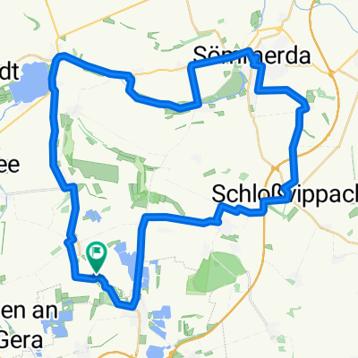
Nöda Bienstedt
- 52.6 km
- 341 m
- 344 m
- Nöda, Thuringia, Germany
Nöda-Mittelhausen-Stotternheim-Schwerborn-Stollberg Siedlung-Ringelberg-Linderbach-Urbich-Niedernissa-Rohda-Obernissa-Sohnstedt-Mönchenholzhausen-Hochstedt-Vieselbach-Kleinmölsen-Udestedt-Schwerborn-Stotternheim-Nöda
Road
22.3 km40 %Track
16.7 km30 %Paved
49 km(88 %)Asphalt
48.4 km87 %Paved (undefined)
0.6 km1 %Undefined
6.7 km12 %Free trial for 3 days, or one-time payment. More about Bikemap Premium.
Discover more Premium features.
Get Bikemap PremiumOpen it in the app