

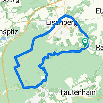
weimar_eisenberg
A cycling route starting in Rauda, Thuringia, Germany.
Overview
About this route
- -:--
- Duration
- 65.4 km
- Distance
- 326 m
- Ascent
- 326 m
- Descent
- ---
- Avg. speed
- ---
- Max. altitude
Continue with Bikemap
Use, edit, or download this cycling route
You would like to ride weimar_eisenberg or customize it for your own trip? Here is what you can do with this Bikemap route:
Free features
- Save this route as favorite or in collections
- Copy & plan your own version of this route
- Sync your route with Garmin or Wahoo
Premium features
Free trial for 3 days, or one-time payment. More about Bikemap Premium.
- Navigate this route on iOS & Android
- Export a GPX / KML file of this route
- Create your custom printout (try it for free)
- Download this route for offline navigation
Discover more Premium features.
Get Bikemap PremiumFrom our community
Other popular routes starting in Rauda
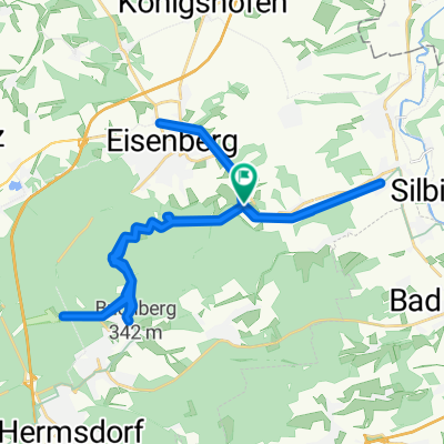
 Bahnhofstraße 4, Rauda nach Kleiner Brühl 3, Eisenberg
- Distance
- 5.5 km
- Ascent
- 88 m
- Descent
- 3 m
- Location
- Rauda, Thuringia, Germany
 eisenberg hohenstein-Ernstthal
- Distance
- 75.8 km
- Ascent
- 514 m
- Descent
- 282 m
- Location
- Rauda, Thuringia, Germany
 Mühltal 2
- Distance
- 19.3 km
- Ascent
- 221 m
- Descent
- 223 m
- Location
- Rauda, Thuringia, Germany
 Mühltaltour.gpx
- Distance
- 7.1 km
- Ascent
- 206 m
- Descent
- 115 m
- Location
- Rauda, Thuringia, Germany
 Mühltalsweg 11–13, Eisenberg nach Mühltalsweg 11–13, Eisenberg
- Distance
- 52.6 km
- Ascent
- 785 m
- Descent
- 788 m
- Location
- Rauda, Thuringia, Germany
 20.4.2020
- Distance
- 3.7 km
- Ascent
- 109 m
- Descent
- 110 m
- Location
- Rauda, Thuringia, Germany
 Brief ride through Eisenberg
- Distance
- 8.9 km
- Ascent
- 137 m
- Descent
- 97 m
- Location
- Rauda, Thuringia, Germany
 Etzdorfer Hof - Unterwellenborn
- Distance
- 109 km
- Ascent
- 1,234 m
- Descent
- 1,230 m
- Location
- Rauda, Thuringia, Germany
Open it in the app