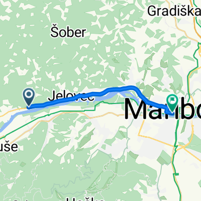
Vzpon na Pohorje z Bistrice ob dravi
A cycling route starting in Bistrica ob Dravi, Ruše Municipality, Slovenia.
Overview
About this route
- -:--
- Duration
- 30.3 km
- Distance
- 961 m
- Ascent
- 961 m
- Descent
- ---
- Avg. speed
- ---
- Max. altitude
Route quality
Waytypes & surfaces along the route
Waytypes
Track
15.5 km
(51 %)
Quiet road
10.3 km
(34 %)
Surfaces
Paved
6.1 km
(20 %)
Unpaved
18.2 km
(60 %)
Gravel
12.7 km
(42 %)
Asphalt
4.2 km
(14 %)
Continue with Bikemap
Use, edit, or download this cycling route
You would like to ride Vzpon na Pohorje z Bistrice ob dravi or customize it for your own trip? Here is what you can do with this Bikemap route:
Free features
- Save this route as favorite or in collections
- Copy & plan your own version of this route
- Sync your route with Garmin or Wahoo
Premium features
Free trial for 3 days, or one-time payment. More about Bikemap Premium.
- Navigate this route on iOS & Android
- Export a GPX / KML file of this route
- Create your custom printout (try it for free)
- Download this route for offline navigation
Discover more Premium features.
Get Bikemap PremiumFrom our community
Other popular routes starting in Bistrica ob Dravi
- Vzpon na Pohorje z Bistrice ob dravi
- Distance
- 30.3 km
- Ascent
- 961 m
- Descent
- 961 m
- Location
- Bistrica ob Dravi, Ruše Municipality, Slovenia
- Dom-Pecke-Martnica-Dom
- Distance
- 19.2 km
- Ascent
- 872 m
- Descent
- 876 m
- Location
- Bistrica ob Dravi, Ruše Municipality, Slovenia
- Ruše-Činžat-Lehen-Podvelka-Ruše
- Distance
- 51 km
- Ascent
- 445 m
- Descent
- 444 m
- Location
- Bistrica ob Dravi, Ruše Municipality, Slovenia
- bazena - bellevue
- Distance
- 18 km
- Ascent
- 1,779 m
- Descent
- 1,035 m
- Location
- Bistrica ob Dravi, Ruše Municipality, Slovenia
- Medic-Kungota
- Distance
- 41.8 km
- Ascent
- 551 m
- Descent
- 551 m
- Location
- Bistrica ob Dravi, Ruše Municipality, Slovenia
- Fram - Areh
- Distance
- 52.7 km
- Ascent
- 1,066 m
- Descent
- 1,066 m
- Location
- Bistrica ob Dravi, Ruše Municipality, Slovenia
- Reški vrh
- Distance
- 25.4 km
- Ascent
- 897 m
- Descent
- 894 m
- Location
- Bistrica ob Dravi, Ruše Municipality, Slovenia
- Log 47 to Å olska ulica 8
- Distance
- 13.5 km
- Ascent
- 111 m
- Descent
- 203 m
- Location
- Bistrica ob Dravi, Ruše Municipality, Slovenia
Open it in the app