

1.5.10 - Durchs Blütenmeer der Apfelstrasse - Kulm
A cycling route starting in Fernitz, Styria, Austria.
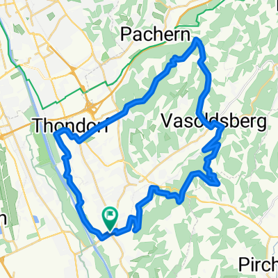
Overview
About this route
Beautiful and varied route with many climbs on quiet secondary roads with great views over South Styria.
- -:--
- Duration
- 116.9 km
- Distance
- 1,203 m
- Ascent
- 1,203 m
- Descent
- ---
- Avg. speed
- ---
- Max. altitude

Route quality
Waytypes & surfaces along the route
Waytypes
Quiet road
39.7 km
(34 %)
Road
21 km
(18 %)
Surfaces
Paved
86.5 km
(74 %)
Unpaved
4.7 km
(4 %)
Asphalt
85.3 km
(73 %)
Gravel
3.5 km
(3 %)
Continue with Bikemap
Use, edit, or download this cycling route
You would like to ride 1.5.10 - Durchs Blütenmeer der Apfelstrasse - Kulm or customize it for your own trip? Here is what you can do with this Bikemap route:
Free features
- Save this route as favorite or in collections
- Copy & plan your own version of this route
- Split it into stages to create a multi-day tour
- Sync your route with Garmin or Wahoo
Premium features
Free trial for 3 days, or one-time payment. More about Bikemap Premium.
- Navigate this route on iOS & Android
- Export a GPX / KML file of this route
- Create your custom printout (try it for free)
- Download this route for offline navigation
Discover more Premium features.
Get Bikemap PremiumFrom our community
Other popular routes starting in Fernitz
 19.05.12 - Rund um den Schöckl
- Distance
- 95.9 km
- Ascent
- 1,010 m
- Descent
- 1,010 m
- Location
- Fernitz, Styria, Austria
 19.02.11 - MTB - Mellachberg
- Distance
- 13.1 km
- Ascent
- 335 m
- Descent
- 331 m
- Location
- Fernitz, Styria, Austria
 Hügelige Runde - Apfelstrasse - Kulm
- Distance
- 115 km
- Ascent
- 2,067 m
- Descent
- 1,988 m
- Location
- Fernitz, Styria, Austria
 7.4.10 - MTB Extra - Plabutsch - Florianiberg
- Distance
- 46.2 km
- Ascent
- 569 m
- Descent
- 570 m
- Location
- Fernitz, Styria, Austria
 fernitz-hühnerberg-schloss waasen-kollisch-werndorf-kalsdorf-fernitz
- Distance
- 30.6 km
- Ascent
- 254 m
- Descent
- 253 m
- Location
- Fernitz, Styria, Austria
 17.03-12 - Von Fernitz Richtung Süden
- Distance
- 50.3 km
- Ascent
- 453 m
- Descent
- 450 m
- Location
- Fernitz, Styria, Austria
 Badgamser Panoramastraße
- Distance
- 82.7 km
- Ascent
- 952 m
- Descent
- 951 m
- Location
- Fernitz, Styria, Austria
 Wolfsgrabenrunde
- Distance
- 32.3 km
- Ascent
- 411 m
- Descent
- 410 m
- Location
- Fernitz, Styria, Austria
Open it in the app