
St Julien le Montagnier - Ste Baume - 29 Déc. 18
A cycling route starting in Gémenos, Provence-Alpes-Côte d'Azur Region, France.
Overview
About this route
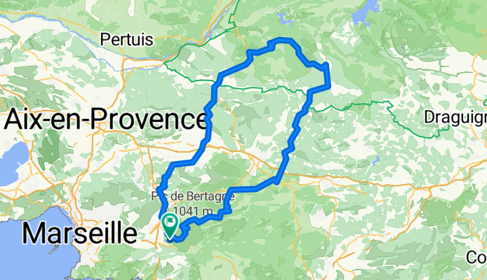
Gémenos - St Jean de Garguier - Roquevaire – La Destrousse – La Bouilladisse – Le Pigeonnier - cote 432 m - Peynier - Trets - Pourrières – Pain de Munition ( cote 490 m ) - Rians – Ginasservis – St Julien le Montagnier ( 570 m ) – St Pierre – Les Rouvières – La Mourotte – Malassoque ( cote 560 m ) – Montmeyan – cote 530 m – Tavernes – Barjols – Bras – Tourves – Rougiers – Golf de Châteauneuf - Nans les Pins - Hôtellerie de la Ste Baume - Plan d'Aups - Col de l'Espigoulier ( 728 m ) - Gémenos.
- -:--
- Duration
- 174.7 km
- Distance
- 1,459 m
- Ascent
- 1,458 m
- Descent
- ---
- Avg. speed
- ---
- Max. altitude

Route quality
Waytypes & surfaces along the route
Waytypes
Busy road
107.2 km
(61 %)
Road
50.3 km
(29 %)
Surfaces
Paved
90.2 km
(52 %)
Unpaved
0 km
(<1 %)
Asphalt
89.6 km
(51 %)
Paving stones
0.6 km
(<1 %)
Continue with Bikemap
Use, edit, or download this cycling route
You would like to ride St Julien le Montagnier - Ste Baume - 29 Déc. 18 or customize it for your own trip? Here is what you can do with this Bikemap route:
Free features
- Save this route as favorite or in collections
- Copy & plan your own version of this route
- Split it into stages to create a multi-day tour
- Sync your route with Garmin or Wahoo
Premium features
Free trial for 3 days, or one-time payment. More about Bikemap Premium.
- Navigate this route on iOS & Android
- Export a GPX / KML file of this route
- Create your custom printout (try it for free)
- Download this route for offline navigation
Discover more Premium features.
Get Bikemap PremiumFrom our community
Other popular routes starting in Gémenos
 Massif de la Sainte Baume 2
- Distance
- 56.9 km
- Ascent
- 787 m
- Descent
- 787 m
- Location
- Gémenos, Provence-Alpes-Côte d'Azur Region, France
 grand caunet-tour du castelet-grand caunet
- Distance
- 52.1 km
- Ascent
- 524 m
- Descent
- 524 m
- Location
- Gémenos, Provence-Alpes-Côte d'Azur Region, France
 --Gémenos-- OR-2996574:Gémenos->Heuchelheim étape 1
- Distance
- 121.7 km
- Ascent
- 941 m
- Descent
- 617 m
- Location
- Gémenos, Provence-Alpes-Côte d'Azur Region, France
 Sainte Baume
- Distance
- 60.2 km
- Ascent
- 1,139 m
- Descent
- 1,139 m
- Location
- Gémenos, Provence-Alpes-Côte d'Azur Region, France
 Ste Baume - RP 52 - n°3 - 6 Nov. 15
- Distance
- 159.6 km
- Ascent
- 2,090 m
- Descent
- 2,087 m
- Location
- Gémenos, Provence-Alpes-Côte d'Azur Region, France
 St Julien le Montagnier - Ste Baume - 29 Déc. 18
- Distance
- 174.7 km
- Ascent
- 1,459 m
- Descent
- 1,458 m
- Location
- Gémenos, Provence-Alpes-Côte d'Azur Region, France
 Ste Baume Bikemap
- Distance
- 19.7 km
- Ascent
- 897 m
- Descent
- 891 m
- Location
- Gémenos, Provence-Alpes-Côte d'Azur Region, France
 L'espi par Auriol
- Distance
- 37.8 km
- Ascent
- 759 m
- Descent
- 759 m
- Location
- Gémenos, Provence-Alpes-Côte d'Azur Region, France
Open it in the app