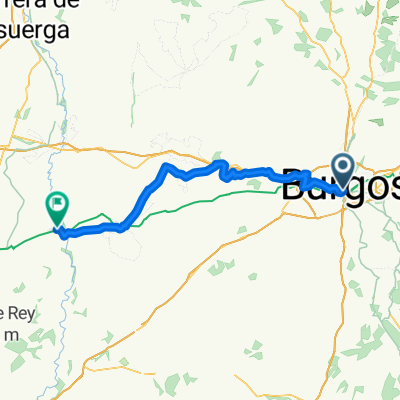
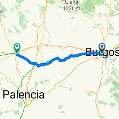
Camino Natural Santander-Mediterráneo hasta Peñahorada
A cycling route starting in Burgos, Castille and León, Spain.
Overview
About this route
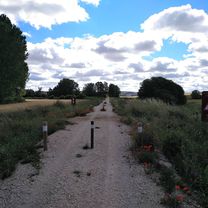
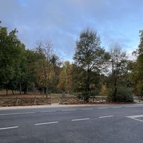
The road from the industrial estate was muddy since it provides access to estates, with many tractor tracks and, at times, the old gravel of the paths up to the junction with the road to Sotragero, where the Camino is already marked and the surface is perfect.
Another problem was the wind, which shakes mercilessly until reaching the trenches and tunnels of Peñahorada.
A very beautiful and well-conditioned route... except for its connection with Burgos. Let's hope it gets solved soon.
- -:--
- Duration
- 20.4 km
- Distance
- 129 m
- Ascent
- 85 m
- Descent
- ---
- Avg. speed
- ---
- Max. altitude
Continue with Bikemap
Use, edit, or download this cycling route
You would like to ride Camino Natural Santander-Mediterráneo hasta Peñahorada or customize it for your own trip? Here is what you can do with this Bikemap route:
Free features
- Save this route as favorite or in collections
- Copy & plan your own version of this route
- Sync your route with Garmin or Wahoo
Premium features
Free trial for 3 days, or one-time payment. More about Bikemap Premium.
- Navigate this route on iOS & Android
- Export a GPX / KML file of this route
- Create your custom printout (try it for free)
- Download this route for offline navigation
Discover more Premium features.
Get Bikemap PremiumFrom our community
Other popular routes starting in Burgos
Calle de San Pablo, Burgos to Burgos- Distance
- 11.4 km
- Ascent
- 39 m
- Descent
- 42 m
- Location
- Burgos, Castille and León, Spain
BCB. Ruta Día de las Vías Verdes 2017. Versión fácil- Distance
- 47.4 km
- Ascent
- 198 m
- Descent
- 197 m
- Location
- Burgos, Castille and León, Spain
2025. 1 nap El Camino- Distance
- 86.3 km
- Ascent
- 535 m
- Descent
- 565 m
- Location
- Burgos, Castille and León, Spain
Burgos - Itero de la Vega- Distance
- 64.5 km
- Ascent
- 575 m
- Descent
- 668 m
- Location
- Burgos, Castille and León, Spain
Inmunización 2.1 - Viajando al Paleolítico.- Distance
- 52.8 km
- Ascent
- 515 m
- Descent
- 516 m
- Location
- Burgos, Castille and León, Spain
Anormalidad 0.1- Distance
- 45.8 km
- Ascent
- 242 m
- Descent
- 242 m
- Location
- Burgos, Castille and León, Spain
Jakobsweg 5. 29.8.05 Carrion de los Condes- Distance
- 98.1 km
- Ascent
- 476 m
- Descent
- 536 m
- Location
- Burgos, Castille and León, Spain
Camino frances"Burgos - SANTIAGO DE COMPOSTELA"- Distance
- 658.3 km
- Ascent
- 2,735 m
- Descent
- 3,543 m
- Location
- Burgos, Castille and León, Spain
Open it in the app


