

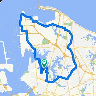
Glasgow
A cycling route starting in Norfolk, Virginia, United States.
Overview
About this route
bike route
- -:--
- Duration
- 397.7 km
- Distance
- 763 m
- Ascent
- 544 m
- Descent
- ---
- Avg. speed
- ---
- Max. altitude

Route quality
Waytypes & surfaces along the route
Waytypes
Road
182.9 km
(46 %)
Quiet road
55.7 km
(14 %)
Surfaces
Paved
27.8 km
(7 %)
Unpaved
35.8 km
(9 %)
Gravel
35.8 km
(9 %)
Asphalt
23.9 km
(6 %)
Continue with Bikemap
Use, edit, or download this cycling route
You would like to ride Glasgow or customize it for your own trip? Here is what you can do with this Bikemap route:
Free features
- Save this route as favorite or in collections
- Copy & plan your own version of this route
- Split it into stages to create a multi-day tour
- Sync your route with Garmin or Wahoo
Premium features
Free trial for 3 days, or one-time payment. More about Bikemap Premium.
- Navigate this route on iOS & Android
- Export a GPX / KML file of this route
- Create your custom printout (try it for free)
- Download this route for offline navigation
Discover more Premium features.
Get Bikemap PremiumFrom our community
Other popular routes starting in Norfolk
 415 St Paul's Blvd, Norfolk to 1389–1399 Auburn Hill Dr, Chesapeake
- Distance
- 19.1 km
- Ascent
- 80 m
- Descent
- 61 m
- Location
- Norfolk, Virginia, United States
 Long ride through Norfolk
- Distance
- 43.3 km
- Ascent
- 20 m
- Descent
- 19 m
- Location
- Norfolk, Virginia, United States
 Vimy Ridge Avenue 3111, Norfolk to East Ocean View Avenue 835, Norfolk
- Distance
- 10.5 km
- Ascent
- 7 m
- Descent
- 8 m
- Location
- Norfolk, Virginia, United States
 1444 Dunstan Ln, Virginia Beach to 1572 Eagleton Ln, Virginia Beach
- Distance
- 8.8 km
- Ascent
- 3 m
- Descent
- 3 m
- Location
- Norfolk, Virginia, United States
 4019 Granby St, Norfolk to 570 Caratoke Hwy, Moyock
- Distance
- 47.7 km
- Ascent
- 103 m
- Descent
- 102 m
- Location
- Norfolk, Virginia, United States
 Glasgow
- Distance
- 397.7 km
- Ascent
- 763 m
- Descent
- 544 m
- Location
- Norfolk, Virginia, United States
 NORFOLK BASE/Sewels Point Road
- Distance
- 34.7 km
- Ascent
- 27 m
- Descent
- 30 m
- Location
- Norfolk, Virginia, United States
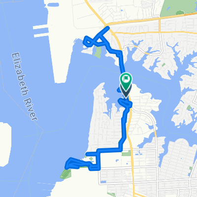 Elizabeth River Trail-North, Norfolk to Richmond Pl, Norfolk
- Distance
- 15.7 km
- Ascent
- 47 m
- Descent
- 49 m
- Location
- Norfolk, Virginia, United States
Open it in the app