

Challenge (End Goal) Part-2
A cycling route starting in Buckie, Scotland, United Kingdom.
Overview
About this route
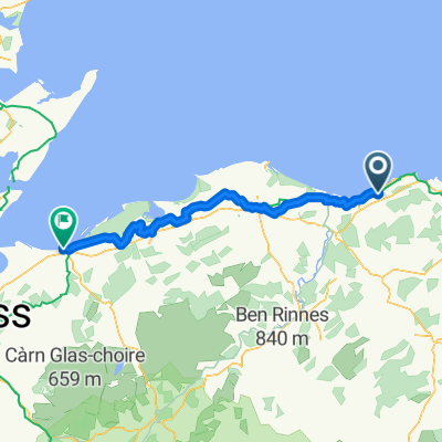
Buckie-Portgordon-Lhambryde-Elgin
14 Miles
- -:--
- Duration
- 23 km
- Distance
- 68 m
- Ascent
- 65 m
- Descent
- ---
- Avg. speed
- ---
- Max. altitude
Route quality
Waytypes & surfaces along the route
Waytypes
Road
11.7 km
(51 %)
Cycleway
5.3 km
(23 %)
Surfaces
Paved
6 km
(26 %)
Asphalt
5.7 km
(25 %)
Paved (undefined)
0.2 km
(1 %)
Undefined
17 km
(74 %)
Continue with Bikemap
Use, edit, or download this cycling route
You would like to ride Challenge (End Goal) Part-2 or customize it for your own trip? Here is what you can do with this Bikemap route:
Free features
- Save this route as favorite or in collections
- Copy & plan your own version of this route
- Sync your route with Garmin or Wahoo
Premium features
Free trial for 3 days, or one-time payment. More about Bikemap Premium.
- Navigate this route on iOS & Android
- Export a GPX / KML file of this route
- Create your custom printout (try it for free)
- Download this route for offline navigation
Discover more Premium features.
Get Bikemap PremiumFrom our community
Other popular routes starting in Buckie
 Day 3 Tues 24 June: Buckie - Victoria Street Nairn
- Distance
- 72.8 km
- Ascent
- 344 m
- Descent
- 363 m
- Location
- Buckie, Scotland, United Kingdom
 route 2
- Distance
- 8.8 km
- Ascent
- 63 m
- Descent
- 61 m
- Location
- Buckie, Scotland, United Kingdom
 Buckie loop
- Distance
- 30.1 km
- Ascent
- 340 m
- Descent
- 342 m
- Location
- Buckie, Scotland, United Kingdom
 04/01/19 (part-2)
- Distance
- 20.1 km
- Ascent
- 82 m
- Descent
- 71 m
- Location
- Buckie, Scotland, United Kingdom
 Monday punisher
- Distance
- 19.4 km
- Ascent
- 283 m
- Descent
- 284 m
- Location
- Buckie, Scotland, United Kingdom
 sunday run....
- Distance
- 18 km
- Ascent
- 218 m
- Descent
- 218 m
- Location
- Buckie, Scotland, United Kingdom
 Challenge (End Goal) Part-2
- Distance
- 23 km
- Ascent
- 68 m
- Descent
- 65 m
- Location
- Buckie, Scotland, United Kingdom
 PEtoLOS
- Distance
- 32.4 km
- Ascent
- 144 m
- Descent
- 161 m
- Location
- Buckie, Scotland, United Kingdom
Open it in the app