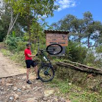
Colombia Part 2
A cycling route starting in Santa Marta, Magdalena Department, Colombia.
Overview
About this route
Santa Marta - Chinchiná (December 2018)
- -:--
- Duration
- 1,112.9 km
- Distance
- 5,179 m
- Ascent
- 3,821 m
- Descent
- ---
- Avg. speed
- ---
- Max. altitude
Continue with Bikemap
Use, edit, or download this cycling route
You would like to ride Colombia Part 2 or customize it for your own trip? Here is what you can do with this Bikemap route:
Free features
- Save this route as favorite or in collections
- Copy & plan your own version of this route
- Split it into stages to create a multi-day tour
- Sync your route with Garmin or Wahoo
Premium features
Free trial for 3 days, or one-time payment. More about Bikemap Premium.
- Navigate this route on iOS & Android
- Export a GPX / KML file of this route
- Create your custom printout (try it for free)
- Download this route for offline navigation
Discover more Premium features.
Get Bikemap PremiumFrom our community
Other popular routes starting in Santa Marta
- calle 11 b#19@54 barrió sanfracisco rodadero sanpablo sanfracisco
- Distance
- 18.8 km
- Ascent
- 297 m
- Descent
- 302 m
- Location
- Santa Marta, Magdalena Department, Colombia
- santamarta taganga santamarta
- Distance
- 8.7 km
- Ascent
- 149 m
- Descent
- 114 m
- Location
- Santa Marta, Magdalena Department, Colombia
- De Calle 11b #19-54, Santa Marta a Calle 11b #19-54, Santa Marta
- Distance
- 17.4 km
- Ascent
- 210 m
- Descent
- 210 m
- Location
- Santa Marta, Magdalena Department, Colombia
- santamarta rodadero gaira santamarta
- Distance
- 10.3 km
- Ascent
- 113 m
- Descent
- 74 m
- Location
- Santa Marta, Magdalena Department, Colombia
- Mamatoco - Minca
- Distance
- 15.5 km
- Ascent
- 699 m
- Descent
- 83 m
- Location
- Santa Marta, Magdalena Department, Colombia
- santamarta paso de promogas peaje SantaMarta
- Distance
- 15.6 km
- Ascent
- 174 m
- Descent
- 22 m
- Location
- Santa Marta, Magdalena Department, Colombia
- Puerto mosquito
- Distance
- 14.3 km
- Ascent
- 128 m
- Descent
- 128 m
- Location
- Santa Marta, Magdalena Department, Colombia
- MAMATOCO - MINCA - CAMPANO - LA CENTRAL - CIÉNAGA
- Distance
- 57 km
- Ascent
- 2,111 m
- Descent
- 2,140 m
- Location
- Santa Marta, Magdalena Department, Colombia
Open it in the app