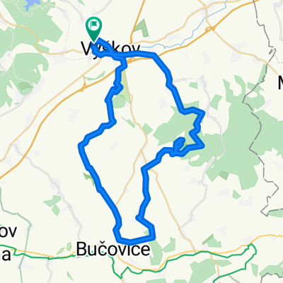

Vyškov - Jedovnice a zpět:)
- 58.6 km
- 764 m
- 765 m
- Vyškov, South Moravian, Czechia
A cycling route starting in Vyškov, South Moravian, Czechia.
Overview
Originally, it was supposed to be a shorter ride to warm up before the trip the next day. Somehow it didn’t work out. Thanks to my persistence, I actually added a bit more :)
Otherwise, the route is passable even on a trekking bike. The section before Bučovice is on a main road. It's quite busy, so I recommend being careful. The same applies to the somewhat busy road from Prusy to Topolany.
According to the odometer, 53.87 km including the detours.
created this 15 years ago
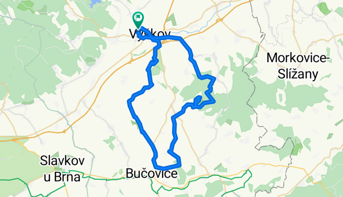
Route highlights
Tady jsem poprvý zabloudil :) Prostě jsem odbočil moc brzo.
A tady se našel :)
Tady jsem zabloudil podruhý, tentokrát vážněji. To je tak, když někdo kouká nepozorně na značky. Následovalo prodírání houštinama do nepěknýho kopca. Po nějaké době nadávání, jsem to prostě sjel zpátky.
Tady jsem se podruhé našel a trochu si zanadával :)
Continue with Bikemap
You would like to ride Vyškov - Větrník - Bučovice - Orlovice - Vyškov (Jantar 2x bloudil :D ) or customize it for your own trip? Here is what you can do with this Bikemap route:
Free trial for 3 days, or one-time payment. More about Bikemap Premium.
Discover more Premium features.
Get Bikemap PremiumFrom our community
Open it in the app