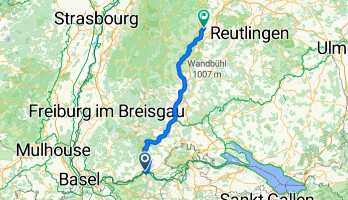
Waldshut - Mötzingen 2010 Vorschlag von Naviki.org
A cycling route starting in Waldshut-Tiengen, Baden-Wurttemberg, Germany.
Overview
About this route
This route was created by naviki.org and still needs to be checked for long-distance cycling suitability.
No details are known yet (gravel or asphalt or similar)
- -:--
- Duration
- 152.1 km
- Distance
- 1,197 m
- Ascent
- 1,005 m
- Descent
- ---
- Avg. speed
- ---
- Max. altitude
Continue with Bikemap
Use, edit, or download this cycling route
You would like to ride Waldshut - Mötzingen 2010 Vorschlag von Naviki.org or customize it for your own trip? Here is what you can do with this Bikemap route:
Free features
- Save this route as favorite or in collections
- Copy & plan your own version of this route
- Split it into stages to create a multi-day tour
- Sync your route with Garmin or Wahoo
Premium features
Free trial for 3 days, or one-time payment. More about Bikemap Premium.
- Navigate this route on iOS & Android
- Export a GPX / KML file of this route
- Create your custom printout (try it for free)
- Download this route for offline navigation
Discover more Premium features.
Get Bikemap PremiumFrom our community
Other popular routes starting in Waldshut-Tiengen
trainingsrunde- Distance
- 30.3 km
- Ascent
- 497 m
- Descent
- 494 m
- Location
- Waldshut-Tiengen, Baden-Wurttemberg, Germany
Waldshut nach Nussbaumen- Distance
- 21.1 km
- Ascent
- 145 m
- Descent
- 84 m
- Location
- Waldshut-Tiengen, Baden-Wurttemberg, Germany
Krankenhaus - Aarberg- Distance
- 3.1 km
- Ascent
- 108 m
- Descent
- 3 m
- Location
- Waldshut-Tiengen, Baden-Wurttemberg, Germany
Waldshut bis Basel- Distance
- 61.5 km
- Ascent
- 85 m
- Descent
- 151 m
- Location
- Waldshut-Tiengen, Baden-Wurttemberg, Germany
SS-RW 2.E Tiengen - Obereichsel (Rheinfelden)- Distance
- 60 km
- Ascent
- 429 m
- Descent
- 329 m
- Location
- Waldshut-Tiengen, Baden-Wurttemberg, Germany
Von Waldshut-Tiengen bis Rheinfelden (Baden)- Distance
- 45.5 km
- Ascent
- 257 m
- Descent
- 322 m
- Location
- Waldshut-Tiengen, Baden-Wurttemberg, Germany
Lauffohr (Brugg) - Basel- Distance
- 68.9 km
- Ascent
- 389 m
- Descent
- 462 m
- Location
- Waldshut-Tiengen, Baden-Wurttemberg, Germany
Tiengen - Hugstetten (Wiesental)- Distance
- 125.6 km
- Ascent
- 837 m
- Descent
- 1,021 m
- Location
- Waldshut-Tiengen, Baden-Wurttemberg, Germany
Open it in the app


