

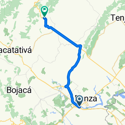
Tabio
A cycling route starting in Mosquera, Cundinamarca, Colombia.
Overview
About this route
- -:--
- Duration
- 34 km
- Distance
- 122 m
- Ascent
- 81 m
- Descent
- ---
- Avg. speed
- ---
- Max. altitude

Route quality
Waytypes & surfaces along the route
Waytypes
Road
7.5 km
(22 %)
Quiet road
4.8 km
(14 %)
Surfaces
Paved
11.6 km
(34 %)
Unpaved
6.1 km
(18 %)
Asphalt
8.9 km
(26 %)
Unpaved (undefined)
6.1 km
(18 %)
Continue with Bikemap
Use, edit, or download this cycling route
You would like to ride Tabio or customize it for your own trip? Here is what you can do with this Bikemap route:
Free features
- Save this route as favorite or in collections
- Copy & plan your own version of this route
- Sync your route with Garmin or Wahoo
Premium features
Free trial for 3 days, or one-time payment. More about Bikemap Premium.
- Navigate this route on iOS & Android
- Export a GPX / KML file of this route
- Create your custom printout (try it for free)
- Download this route for offline navigation
Discover more Premium features.
Get Bikemap PremiumFrom our community
Other popular routes starting in Mosquera
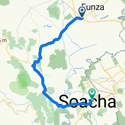
 De Vía Principal Funza, Mosquera a Bogotá-La Vega
- Distance
- 26.6 km
- Ascent
- 395 m
- Descent
- 87 m
- Location
- Mosquera, Cundinamarca, Colombia
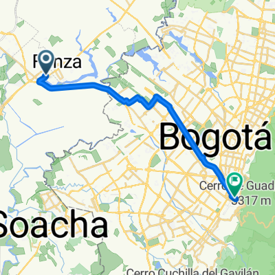
 De Carrera 4 Este 2-2, Mosquera a Carrera 12 20-38, Soacha
- Distance
- 26.9 km
- Ascent
- 306 m
- Descent
- 324 m
- Location
- Mosquera, Cundinamarca, Colombia
 Mosquera- utadeo
- Distance
- 26.3 km
- Ascent
- 326 m
- Descent
- 220 m
- Location
- Mosquera, Cundinamarca, Colombia
 Paseo intenso en Bogotá
- Distance
- 7.9 km
- Ascent
- 0 m
- Descent
- 180 m
- Location
- Mosquera, Cundinamarca, Colombia
 Mondoñedo
- Distance
- 24.4 km
- Ascent
- 154 m
- Descent
- 49 m
- Location
- Mosquera, Cundinamarca, Colombia
 San Jorge, Mosquera a Paralela Ciudad del Sol, Mosquera
- Distance
- 39.1 km
- Ascent
- 261 m
- Descent
- 260 m
- Location
- Mosquera, Cundinamarca, Colombia
 De Avenida troncal de occidente #29-88, Mosquera a La Mesa-Mosquera
- Distance
- 8.8 km
- Ascent
- 261 m
- Descent
- 48 m
- Location
- Mosquera, Cundinamarca, Colombia
 De La Mesa-Mosquera a La Mesa-Mosquera
- Distance
- 8.5 km
- Ascent
- 240 m
- Descent
- 373 m
- Location
- Mosquera, Cundinamarca, Colombia
Open it in the app