

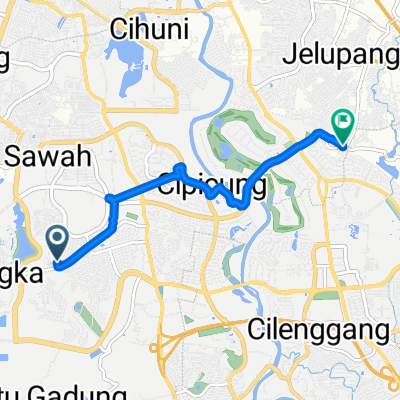
Tour De Padang Mountain
A cycling route starting in Serpong, West Java, Indonesia.
Overview
About this route
- 20 h 47 min
- Duration
- 253.4 km
- Distance
- 2,710 m
- Ascent
- 2,740 m
- Descent
- 12.2 km/h
- Avg. speed
- ---
- Max. altitude

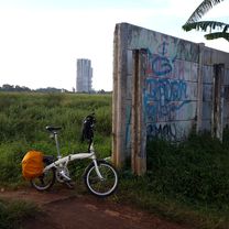
Route photos


Continue with Bikemap
Use, edit, or download this cycling route
You would like to ride Tour De Padang Mountain or customize it for your own trip? Here is what you can do with this Bikemap route:
Free features
- Save this route as favorite or in collections
- Copy & plan your own version of this route
- Split it into stages to create a multi-day tour
- Sync your route with Garmin or Wahoo
Premium features
Free trial for 3 days, or one-time payment. More about Bikemap Premium.
- Navigate this route on iOS & Android
- Export a GPX / KML file of this route
- Create your custom printout (try it for free)
- Download this route for offline navigation
Discover more Premium features.
Get Bikemap PremiumFrom our community
Other popular routes starting in Serpong
 ParungpanjangDago002
- Distance
- 48.2 km
- Ascent
- 423 m
- Descent
- 420 m
- Location
- Serpong, West Java, Indonesia
 Pagedangan to Buaran
- Distance
- 7 km
- Ascent
- 115 m
- Descent
- 152 m
- Location
- Serpong, West Java, Indonesia
 Cisauk - BSD (Tandon Ciater) - Depok
- Distance
- 36 km
- Ascent
- 675 m
- Descent
- 672 m
- Location
- Serpong, West Java, Indonesia
 bejek pedal JPM Paradise bikepark 1lap
- Distance
- 3.7 km
- Ascent
- 19 m
- Descent
- 20 m
- Location
- Serpong, West Java, Indonesia
 Slow ride in Kecamatan Setu
- Distance
- 11.3 km
- Ascent
- 429 m
- Descent
- 477 m
- Location
- Serpong, West Java, Indonesia
 Warung Tuman-JPG-Japinka-Navapark
- Distance
- 15.3 km
- Ascent
- 71 m
- Descent
- 88 m
- Location
- Serpong, West Java, Indonesia
 Parigi - Barong Loop
- Distance
- 14.2 km
- Ascent
- 75 m
- Descent
- 97 m
- Location
- Serpong, West Java, Indonesia
 Tour De Padang Mountain
- Distance
- 253.4 km
- Ascent
- 2,710 m
- Descent
- 2,740 m
- Location
- Serpong, West Java, Indonesia
Open it in the app