

Boehringen - Feldstetten 2
A cycling route starting in Grabenstetten, Baden-Württemberg, Germany.
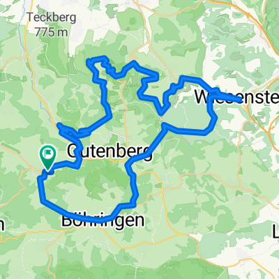
Overview
About this route
am Rand des Biospaerengebiets ehemaliger Truppenuebungsplatz Muensingen
- -:--
- Duration
- 12.4 km
- Distance
- 179 m
- Ascent
- 161 m
- Descent
- ---
- Avg. speed
- ---
- Avg. speed

Route highlights
Points of interest along the route
Point of interest after 3.3 km
die ehemalige Panzer-Ringstrasse, eine extra breite, glatte, leichtgängige Asphaltstrecke darf nicht benutzt werden.
Point of interest after 3.9 km
Aussichtsturm Hursch des Schwaebischen Albvereins. Hoehe 895 m, Turmhoehe 42 m. Maximales Fassungsvermoegen 10 Personen.
Point of interest after 4.7 km
Eingang ins Biosphaerenreservat.
Point of interest after 7.2 km
Aussichtsturm Waldgreut des Schwaebischen Albvereins. Meereshoehe 864 m. Turmhoehe 20 m.
Continue with Bikemap
Use, edit, or download this cycling route
You would like to ride Boehringen - Feldstetten 2 or customize it for your own trip? Here is what you can do with this Bikemap route:
Free features
- Save this route as favorite or in collections
- Copy & plan your own version of this route
- Sync your route with Garmin or Wahoo
Premium features
Free trial for 3 days, or one-time payment. More about Bikemap Premium.
- Navigate this route on iOS & Android
- Export a GPX / KML file of this route
- Create your custom printout (try it for free)
- Download this route for offline navigation
Discover more Premium features.
Get Bikemap PremiumFrom our community
Other popular routes starting in Grabenstetten
 Boehringen - Feldstetten 2
- Distance
- 12.4 km
- Ascent
- 179 m
- Descent
- 161 m
- Location
- Grabenstetten, Baden-Württemberg, Germany
 Pfulb - Boehringen
- Distance
- 5.9 km
- Ascent
- 104 m
- Descent
- 82 m
- Location
- Grabenstetten, Baden-Württemberg, Germany
 Grabenstetten - MTB-Rundtour
- Distance
- 44.9 km
- Ascent
- 937 m
- Descent
- 880 m
- Location
- Grabenstetten, Baden-Württemberg, Germany
 Ulm-Runde mit Donaustückchen
- Distance
- 112.8 km
- Ascent
- 639 m
- Descent
- 639 m
- Location
- Grabenstetten, Baden-Württemberg, Germany
 truppenübung
- Distance
- 48.3 km
- Ascent
- 491 m
- Descent
- 527 m
- Location
- Grabenstetten, Baden-Württemberg, Germany
 Wiesensteig und Breitenstein
- Distance
- 55 km
- Ascent
- 824 m
- Descent
- 824 m
- Location
- Grabenstetten, Baden-Württemberg, Germany
 Grabenstetten - Rundtour 1
- Distance
- 38.4 km
- Ascent
- 761 m
- Descent
- 760 m
- Location
- Grabenstetten, Baden-Württemberg, Germany
 Boehringen - Feldstetten 1
- Distance
- 10.7 km
- Ascent
- 132 m
- Descent
- 122 m
- Location
- Grabenstetten, Baden-Württemberg, Germany
Open it in the app