

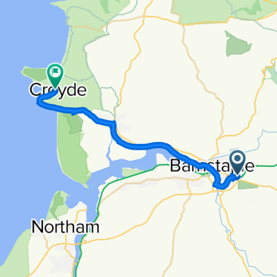
Barnstaple to Lands End
A cycling route starting in Barnstaple, England, United Kingdom.
Overview
About this route
For the girls
- -:--
- Duration
- 263.8 km
- Distance
- 1,007 m
- Ascent
- 943 m
- Descent
- ---
- Avg. speed
- ---
- Max. altitude

Route highlights
Points of interest along the route
Accommodation after 77.7 km
Kitsham Farm campsite
Accommodation after 140 km
Rock Cottage-Prideaux
Accommodation after 151.1 km
River Valley - St Austell
Accommodation after 152.8 km
campsite x 2 539Campsite The Meadows Campsite Pentewan 538Campsite Little Winnick
Accommodation after 161.2 km
Gorran Campsite Trelispen
Accommodation after 163.4 km
Boswinger Campsite Sea View International
Accommodation after 172.5 km
Veryan
Accommodation after 192.3 km
Carnon Downs
Accommodation after 216.5 km
Lavender Fields Touring ParkClose Carnhell Green
Accommodation after 218.3 km
ParbolaClose Carnhell Green
Accommodation after 233.4 km
Wheal RodneyClose Marazion 00-441736710605
Accommodation after 234.8 km
Dove MeadowsClose Marazion 00-441736710854
Accommodation after 250.5 km
Boleigh FarmClose Penzance 00-441736810305
Accommodation after 254.3 km
Tower ParkClose Saint Buryan 00-441736810286
Accommodation after 261.3 km
2 x campsites Sennen Campsite First and Last Inn (only tents) Sennan Campsite Sea View
Continue with Bikemap
Use, edit, or download this cycling route
You would like to ride Barnstaple to Lands End or customize it for your own trip? Here is what you can do with this Bikemap route:
Free features
- Save this route as favorite or in collections
- Copy & plan your own version of this route
- Split it into stages to create a multi-day tour
- Sync your route with Garmin or Wahoo
Premium features
Free trial for 3 days, or one-time payment. More about Bikemap Premium.
- Navigate this route on iOS & Android
- Export a GPX / KML file of this route
- Create your custom printout (try it for free)
- Download this route for offline navigation
Discover more Premium features.
Get Bikemap PremiumFrom our community
Other popular routes starting in Barnstaple
 periple 11 - 7
- Distance
- 139.5 km
- Ascent
- 1,104 m
- Descent
- 946 m
- Location
- Barnstaple, England, United Kingdom
 Day 07 Barnstaple to Dulverton (LEJOG Stage_05)
- Distance
- 51.6 km
- Ascent
- 863 m
- Descent
- 725 m
- Location
- Barnstaple, England, United Kingdom
 Devon C2C 1 - Croyd Bay (Flat)
- Distance
- 19.9 km
- Ascent
- 93 m
- Descent
- 93 m
- Location
- Barnstaple, England, United Kingdom
 Coast to Coast B to O
- Distance
- 58.5 km
- Ascent
- 445 m
- Descent
- 302 m
- Location
- Barnstaple, England, United Kingdom
 Marwood to Combe Martin hills
- Distance
- 64.8 km
- Ascent
- 857 m
- Descent
- 857 m
- Location
- Barnstaple, England, United Kingdom
 Devon C2C 2
- Distance
- 69.4 km
- Ascent
- 773 m
- Descent
- 647 m
- Location
- Barnstaple, England, United Kingdom
 Barnstaple to Ocean Backpackers
- Distance
- 29.6 km
- Ascent
- 640 m
- Descent
- 634 m
- Location
- Barnstaple, England, United Kingdom
 Tour du Try
- Distance
- 99.1 km
- Ascent
- 657 m
- Descent
- 657 m
- Location
- Barnstaple, England, United Kingdom
Open it in the app