

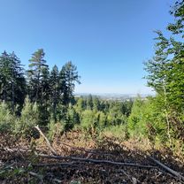
tapa wro
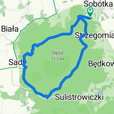
A cycling route starting in Sobótka, Lower Silesian Voivodeship, Poland.
Overview
About this route
- -:--
- Duration
- 46.4 km
- Distance
- 71 m
- Ascent
- 327 m
- Descent
- ---
- Avg. speed
- ---
- Max. altitude

Route quality
Waytypes & surfaces along the route
Waytypes
Road
28.3 km
(61 %)
Track
5.6 km
(12 %)
Surfaces
Paved
29.7 km
(64 %)
Unpaved
1.9 km
(4 %)
Asphalt
29.3 km
(63 %)
Unpaved (undefined)
1.4 km
(3 %)
Continue with Bikemap
Use, edit, or download this cycling route
You would like to ride tapa wro or customize it for your own trip? Here is what you can do with this Bikemap route:
Free features
- Save this route as favorite or in collections
- Copy & plan your own version of this route
- Sync your route with Garmin or Wahoo
Premium features
Free trial for 3 days, or one-time payment. More about Bikemap Premium.
- Navigate this route on iOS & Android
- Export a GPX / KML file of this route
- Create your custom printout (try it for free)
- Download this route for offline navigation
Discover more Premium features.
Get Bikemap PremiumFrom our community
Other popular routes starting in Sobótka
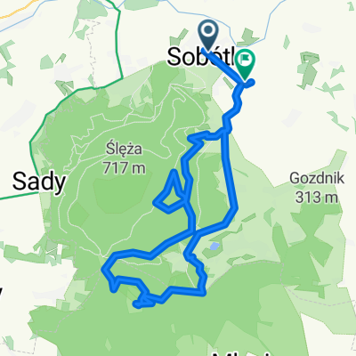
 Pętelka wokół Ślęży czarnym szlakiem
- Distance
- 17.9 km
- Ascent
- 387 m
- Descent
- 387 m
- Location
- Sobótka, Lower Silesian Voivodeship, Poland
 Fryderyka Chopina, Sobótka do Pana Tadeusza, Strzegomiany
- Distance
- 29.2 km
- Ascent
- 728 m
- Descent
- 730 m
- Location
- Sobótka, Lower Silesian Voivodeship, Poland
 Przy Tamie 4, Borzygniew do Przy Tamie 4, Borzygniew
- Distance
- 18.7 km
- Ascent
- 109 m
- Descent
- 160 m
- Location
- Sobótka, Lower Silesian Voivodeship, Poland
 tapa wro
- Distance
- 46.4 km
- Ascent
- 71 m
- Descent
- 327 m
- Location
- Sobótka, Lower Silesian Voivodeship, Poland
 Armii Krajowej do Kotlarska
- Distance
- 36.8 km
- Ascent
- 886 m
- Descent
- 967 m
- Location
- Sobótka, Lower Silesian Voivodeship, Poland
 Relaxed Morning Ride In Marcinowice
- Distance
- 7.4 km
- Ascent
- 46 m
- Descent
- 48 m
- Location
- Sobótka, Lower Silesian Voivodeship, Poland
 Propozycja trasy MTB trasy dla klientów Green eBikes
- Distance
- 33.3 km
- Ascent
- 582 m
- Descent
- 582 m
- Location
- Sobótka, Lower Silesian Voivodeship, Poland
 al. św. Anny do al. św. Anny
- Distance
- 36.3 km
- Ascent
- 645 m
- Descent
- 683 m
- Location
- Sobótka, Lower Silesian Voivodeship, Poland
Open it in the app