

Maggies to Maggies
A cycling route starting in Bebington, England, United Kingdom.
Overview
About this route
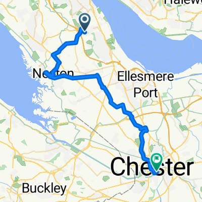
Bebington to Withington, following the Cheshire Cycleway where possible.
- -:--
- Duration
- 86.1 km
- Distance
- 302 m
- Ascent
- 295 m
- Descent
- ---
- Avg. speed
- ---
- Max. altitude
Route quality
Waytypes & surfaces along the route
Waytypes
Road
40.5 km
(47 %)
Quiet road
24.1 km
(28 %)
Surfaces
Paved
32.7 km
(38 %)
Asphalt
25.8 km
(30 %)
Paved (undefined)
6.9 km
(8 %)
Undefined
53.4 km
(62 %)
Continue with Bikemap
Use, edit, or download this cycling route
You would like to ride Maggies to Maggies or customize it for your own trip? Here is what you can do with this Bikemap route:
Free features
- Save this route as favorite or in collections
- Copy & plan your own version of this route
- Split it into stages to create a multi-day tour
- Sync your route with Garmin or Wahoo
Premium features
Free trial for 3 days, or one-time payment. More about Bikemap Premium.
- Navigate this route on iOS & Android
- Export a GPX / KML file of this route
- Create your custom printout (try it for free)
- Download this route for offline navigation
Discover more Premium features.
Get Bikemap PremiumFrom our community
Other popular routes starting in Bebington
 Tour de wirral 44mls
- Distance
- 71.2 km
- Ascent
- 262 m
- Descent
- 262 m
- Location
- Bebington, England, United Kingdom
 Maggies to Maggies
- Distance
- 86.1 km
- Ascent
- 302 m
- Descent
- 295 m
- Location
- Bebington, England, United Kingdom
 Brimstage Courtyard, Brimstage Road, Wirral to 50 Princes Ave, Wirral
- Distance
- 7.7 km
- Ascent
- 61 m
- Descent
- 68 m
- Location
- Bebington, England, United Kingdom
 10–28 Cross Lane, Bebington, Wirral to 61 Cross Lane, Wirral
- Distance
- 64.2 km
- Ascent
- 283 m
- Descent
- 279 m
- Location
- Bebington, England, United Kingdom
 Home-Wirral Way-Chester 40mls
- Distance
- 64.8 km
- Ascent
- 123 m
- Descent
- 154 m
- Location
- Bebington, England, United Kingdom
 Home-Groves Chester
- Distance
- 34.1 km
- Ascent
- 108 m
- Descent
- 141 m
- Location
- Bebington, England, United Kingdom
 Kings Lane 127, Birkenhead to Kings Lane 98, Birkenhead
- Distance
- 25.4 km
- Ascent
- 242 m
- Descent
- 241 m
- Location
- Bebington, England, United Kingdom
 arnot way-anderton-aintree
- Distance
- 96 km
- Ascent
- 235 m
- Descent
- 268 m
- Location
- Bebington, England, United Kingdom
Open it in the app