Poggio delle Oche
A cycling route starting in Sasso Marconi, Emilia-Romagna, Italy.
Overview
About this route
Having left the car on via del Sasso (SP 37), we set off up via Colliva, which starts with a steep section and continues uphill on a paved road. After 3 km, the road ends, leading into the forest, and emerges onto via Torricella, a gravel road, before heading towards via delle Orchidee which leads onto the main road.
- -:--
- Duration
- 6.9 km
- Distance
- 382 m
- Ascent
- 107 m
- Descent
- ---
- Avg. speed
- ---
- Max. altitude
Route quality
Waytypes & surfaces along the route
Waytypes
Quiet road
5.1 km
(73 %)
Path
0.3 km
(5 %)
Undefined
1.5 km
(22 %)
Surfaces
Paved
3.5 km
(51 %)
Unpaved
3.3 km
(48 %)
Asphalt
3.5 km
(51 %)
Unpaved (undefined)
3 km
(43 %)
Continue with Bikemap
Use, edit, or download this cycling route
You would like to ride Poggio delle Oche or customize it for your own trip? Here is what you can do with this Bikemap route:
Free features
- Save this route as favorite or in collections
- Copy & plan your own version of this route
- Sync your route with Garmin or Wahoo
Premium features
Free trial for 3 days, or one-time payment. More about Bikemap Premium.
- Navigate this route on iOS & Android
- Export a GPX / KML file of this route
- Create your custom printout (try it for free)
- Download this route for offline navigation
Discover more Premium features.
Get Bikemap PremiumFrom our community
Other popular routes starting in Sasso Marconi
 Badolo e Monte Alto
- Distance
- 11.1 km
- Ascent
- 457 m
- Descent
- 395 m
- Location
- Sasso Marconi, Emilia-Romagna, Italy
 Monte mario Sasso Marconi (Bo)
- Distance
- 25.3 km
- Ascent
- 644 m
- Descent
- 644 m
- Location
- Sasso Marconi, Emilia-Romagna, Italy
 Anello Badolo Monte del Frate Valle Raibano
- Distance
- 8.3 km
- Ascent
- 352 m
- Descent
- 352 m
- Location
- Sasso Marconi, Emilia-Romagna, Italy
 2014_Kempten-Bolsena_07
- Distance
- 124.3 km
- Ascent
- 1,054 m
- Descent
- 1,105 m
- Location
- Sasso Marconi, Emilia-Romagna, Italy
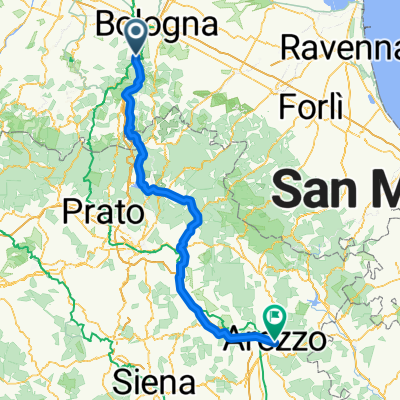
 Italia NS - 03 Sasso Marconi - Arezzo
- Distance
- 176.1 km
- Ascent
- 1,116 m
- Descent
- 982 m
- Location
- Sasso Marconi, Emilia-Romagna, Italy
 DH Badolo
- Distance
- 17.8 km
- Ascent
- 477 m
- Descent
- 474 m
- Location
- Sasso Marconi, Emilia-Romagna, Italy
 Poggio delle Oche
- Distance
- 6.9 km
- Ascent
- 382 m
- Descent
- 107 m
- Location
- Sasso Marconi, Emilia-Romagna, Italy
 Anello Monte Mario; Monte dei Frati; Fosso Raibano
- Distance
- 24.9 km
- Ascent
- 785 m
- Descent
- 786 m
- Location
- Sasso Marconi, Emilia-Romagna, Italy
Open it in the app


