

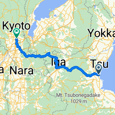
Tsu to Ise version 2
A cycling route starting in Tsu, Mie, Japan.
Overview
About this route
- -:--
- Duration
- 43.8 km
- Distance
- 20 m
- Ascent
- 17 m
- Descent
- ---
- Avg. speed
- ---
- Max. altitude

Route quality
Waytypes & surfaces along the route
Waytypes
Quiet road
25.9 km
(59 %)
Road
6.1 km
(14 %)
Surfaces
Paved
17.1 km
(39 %)
Paved (undefined)
17.1 km
(39 %)
Undefined
26.7 km
(61 %)
Continue with Bikemap
Use, edit, or download this cycling route
You would like to ride Tsu to Ise version 2 or customize it for your own trip? Here is what you can do with this Bikemap route:
Free features
- Save this route as favorite or in collections
- Copy & plan your own version of this route
- Sync your route with Garmin or Wahoo
Premium features
Free trial for 3 days, or one-time payment. More about Bikemap Premium.
- Navigate this route on iOS & Android
- Export a GPX / KML file of this route
- Create your custom printout (try it for free)
- Download this route for offline navigation
Discover more Premium features.
Get Bikemap PremiumFrom our community
Other popular routes starting in Tsu
 Tsu Kyoto
- Distance
- 112.2 km
- Ascent
- 1,033 m
- Descent
- 1,003 m
- Location
- Tsu, Mie, Japan
 Length of Japan Tsu-Kyoto
- Distance
- 112.2 km
- Ascent
- 880 m
- Descent
- 853 m
- Location
- Tsu, Mie, Japan
 Day 9 - Tsu to Iga
- Distance
- 53.6 km
- Ascent
- 560 m
- Descent
- 410 m
- Location
- Tsu, Mie, Japan
 Length of Japan Tsu-Kyoto CLONED FROM ROUTE 317322
- Distance
- 112.2 km
- Ascent
- 880 m
- Descent
- 853 m
- Location
- Tsu, Mie, Japan
 Length of Japan Tsu-Kyoto
- Distance
- 112.2 km
- Ascent
- 1,009 m
- Descent
- 979 m
- Location
- Tsu, Mie, Japan
 Tokaido (Tokyo - Kyoto)
- Distance
- 567.7 km
- Ascent
- 1,027 m
- Descent
- 997 m
- Location
- Tsu, Mie, Japan
 La Palmedor
- Distance
- 7.5 km
- Ascent
- 44 m
- Descent
- 16 m
- Location
- Tsu, Mie, Japan
 Tsu to Ise version 2
- Distance
- 43.8 km
- Ascent
- 20 m
- Descent
- 17 m
- Location
- Tsu, Mie, Japan
Open it in the app