

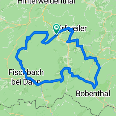
Dahn-Hinterweidental-Johanniskreuz-Kindsbach
A cycling route starting in Dahn, Rhineland-Palatinate, Germany.
Overview
About this route
Ende : Bahnhof Kindsbach
Dahn-Hinterweidental-Johanniskreuz-Kindsbach
70 km, 920 hm
- -:--
- Duration
- 70.8 km
- Distance
- 738 m
- Ascent
- 695 m
- Descent
- ---
- Avg. speed
- ---
- Max. altitude

Route quality
Waytypes & surfaces along the route
Waytypes
Track
50.3 km
(71 %)
Quiet road
9.9 km
(14 %)
Surfaces
Paved
24.8 km
(35 %)
Unpaved
36.8 km
(52 %)
Asphalt
21.9 km
(31 %)
Gravel
16.3 km
(23 %)
Continue with Bikemap
Use, edit, or download this cycling route
You would like to ride Dahn-Hinterweidental-Johanniskreuz-Kindsbach or customize it for your own trip? Here is what you can do with this Bikemap route:
Free features
- Save this route as favorite or in collections
- Copy & plan your own version of this route
- Sync your route with Garmin or Wahoo
Premium features
Free trial for 3 days, or one-time payment. More about Bikemap Premium.
- Navigate this route on iOS & Android
- Export a GPX / KML file of this route
- Create your custom printout (try it for free)
- Download this route for offline navigation
Discover more Premium features.
Get Bikemap PremiumFrom our community
Other popular routes starting in Dahn
 Dahn-Pirmasens
- Distance
- 21.5 km
- Ascent
- 448 m
- Descent
- 396 m
- Location
- Dahn, Rhineland-Palatinate, Germany
 2012 Dahn Wieslauter+Scheidbachtal
- Distance
- 14.8 km
- Ascent
- 396 m
- Descent
- 252 m
- Location
- Dahn, Rhineland-Palatinate, Germany
 2012 Dahn Biosphärentour
- Distance
- 39.8 km
- Ascent
- 399 m
- Descent
- 399 m
- Location
- Dahn, Rhineland-Palatinate, Germany
 Ritterrunde Dahn 30042017
- Distance
- 46.5 km
- Ascent
- 569 m
- Descent
- 569 m
- Location
- Dahn, Rhineland-Palatinate, Germany
 Wasgau See bios
- Distance
- 58.4 km
- Ascent
- 531 m
- Descent
- 531 m
- Location
- Dahn, Rhineland-Palatinate, Germany
 Biosphären Tour
- Distance
- 35.1 km
- Ascent
- 443 m
- Descent
- 446 m
- Location
- Dahn, Rhineland-Palatinate, Germany
 Raubritter-Tour
- Distance
- 47.6 km
- Ascent
- 800 m
- Descent
- 800 m
- Location
- Dahn, Rhineland-Palatinate, Germany
 Felsenland
- Distance
- 64.4 km
- Ascent
- 575 m
- Descent
- 571 m
- Location
- Dahn, Rhineland-Palatinate, Germany
Open it in the app