

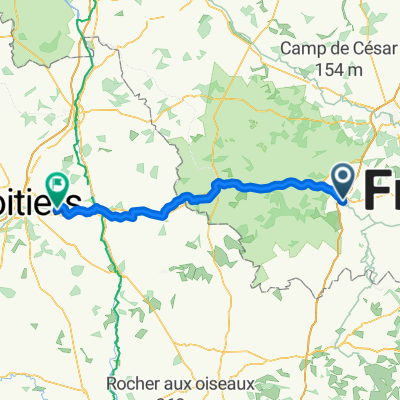
naar ruths camping
A cycling route starting in Argenton-sur-Creuse, Centre-Val de Loire, France.
Overview
About this route
- -:--
- Duration
- 272.6 km
- Distance
- 1,410 m
- Ascent
- 1,402 m
- Descent
- ---
- Avg. speed
- ---
- Max. altitude

Route quality
Waytypes & surfaces along the route
Waytypes
Road
144.5 km
(53 %)
Quiet road
62.7 km
(23 %)
Surfaces
Paved
65.4 km
(24 %)
Unpaved
5.5 km
(2 %)
Asphalt
60 km
(22 %)
Paved (undefined)
5.5 km
(2 %)
Route highlights
Points of interest along the route
Point of interest after 18.7 km
camping
Point of interest after 79.3 km
camping
Point of interest after 133.9 km
camping
Point of interest after 179 km
camping
Point of interest after 235.9 km
camping
Point of interest after 268.6 km
aankomst
Continue with Bikemap
Use, edit, or download this cycling route
You would like to ride naar ruths camping or customize it for your own trip? Here is what you can do with this Bikemap route:
Free features
- Save this route as favorite or in collections
- Copy & plan your own version of this route
- Split it into stages to create a multi-day tour
- Sync your route with Garmin or Wahoo
Premium features
Free trial for 3 days, or one-time payment. More about Bikemap Premium.
- Navigate this route on iOS & Android
- Export a GPX / KML file of this route
- Create your custom printout (try it for free)
- Download this route for offline navigation
Discover more Premium features.
Get Bikemap PremiumFrom our community
Other popular routes starting in Argenton-sur-Creuse
 Ferrières La Chapelle étapes 3, 4 &5
- Distance
- 160.6 km
- Ascent
- 2,552 m
- Descent
- 1,985 m
- Location
- Argenton-sur-Creuse, Centre-Val de Loire, France
 naar ruths camping
- Distance
- 272.6 km
- Ascent
- 1,410 m
- Descent
- 1,402 m
- Location
- Argenton-sur-Creuse, Centre-Val de Loire, France
 2019_E3_Argenton sur creuse-La souterraine
- Distance
- 57.8 km
- Ascent
- 617 m
- Descent
- 319 m
- Location
- Argenton-sur-Creuse, Centre-Val de Loire, France
 Argenton-sur-Creuse - Sèvres-Anxaumont
- Distance
- 99.2 km
- Ascent
- 515 m
- Descent
- 508 m
- Location
- Argenton-sur-Creuse, Centre-Val de Loire, France
 argenton-preuilly
- Distance
- 73.1 km
- Ascent
- 256 m
- Descent
- 270 m
- Location
- Argenton-sur-Creuse, Centre-Val de Loire, France
 Jakobsweg 6a 2.1 (Vézelay über Bourges)
- Distance
- 266.8 km
- Ascent
- 724 m
- Descent
- 609 m
- Location
- Argenton-sur-Creuse, Centre-Val de Loire, France
 argenton sur creuse 4 etapes
- Distance
- 2.3 km
- Ascent
- 16 m
- Descent
- 17 m
- Location
- Argenton-sur-Creuse, Centre-Val de Loire, France
 Argenton s Cr. - L.O.W
- Distance
- 26.9 km
- Ascent
- 407 m
- Descent
- 265 m
- Location
- Argenton-sur-Creuse, Centre-Val de Loire, France
Open it in the app