

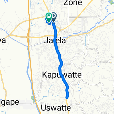
Pamunugama to Kagalle by Tandem
A cycling route starting in Ja Ela, Western Province, Sri Lanka.
Overview
About this route
- 8 h 19 min
- Duration
- 76.1 km
- Distance
- 464 m
- Ascent
- 295 m
- Descent
- 9.1 km/h
- Avg. speed
- ---
- Max. altitude
Continue with Bikemap
Use, edit, or download this cycling route
You would like to ride Pamunugama to Kagalle by Tandem or customize it for your own trip? Here is what you can do with this Bikemap route:
Free features
- Save this route as favorite or in collections
- Copy & plan your own version of this route
- Sync your route with Garmin or Wahoo
Premium features
Free trial for 3 days, or one-time payment. More about Bikemap Premium.
- Navigate this route on iOS & Android
- Export a GPX / KML file of this route
- Create your custom printout (try it for free)
- Download this route for offline navigation
Discover more Premium features.
Get Bikemap PremiumFrom our community
Other popular routes starting in Ja Ela
 Gampaha District to Gampaha District
- Distance
- 10.3 km
- Ascent
- 39 m
- Descent
- 38 m
- Location
- Ja Ela, Western Province, Sri Lanka
 Gampaha District to Gampaha District
- Distance
- 8 km
- Ascent
- 20 m
- Descent
- 21 m
- Location
- Ja Ela, Western Province, Sri Lanka
 Lagooonnnnn
- Distance
- 43 km
- Ascent
- 607 m
- Descent
- 611 m
- Location
- Ja Ela, Western Province, Sri Lanka
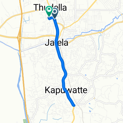
 Pamunugama to pinnawela
- Distance
- 81.6 km
- Ascent
- 378 m
- Descent
- 299 m
- Location
- Ja Ela, Western Province, Sri Lanka
 topaz
topaz- Distance
- 17.4 km
- Ascent
- 24 m
- Descent
- 22 m
- Location
- Ja Ela, Western Province, Sri Lanka
 Gampaha District to Gampaha District
- Distance
- 10.2 km
- Ascent
- 25 m
- Descent
- 26 m
- Location
- Ja Ela, Western Province, Sri Lanka
 Gampaha District to Gampaha District
- Distance
- 9.2 km
- Ascent
- 10 m
- Descent
- 10 m
- Location
- Ja Ela, Western Province, Sri Lanka
 7.079° N 79.881° W to 7.070° N 79.868° W
- Distance
- 1,466.3 km
- Ascent
- 4,422 m
- Descent
- 4,418 m
- Location
- Ja Ela, Western Province, Sri Lanka
Open it in the app