Anda20_52km_920hm_Vinuela
A cycling route starting in Viñuela, Andalusia, Spain.
Overview
About this route
- -:--
- Duration
- 52 km
- Distance
- 879 m
- Ascent
- 879 m
- Descent
- ---
- Avg. speed
- ---
- Max. altitude
Route quality
Waytypes & surfaces along the route
Waytypes
Road
16.6 km
(32 %)
Quiet road
8.8 km
(17 %)
Surfaces
Paved
30.1 km
(58 %)
Unpaved
1.6 km
(3 %)
Asphalt
27.5 km
(53 %)
Paved (undefined)
2.6 km
(5 %)
Continue with Bikemap
Use, edit, or download this cycling route
You would like to ride Anda20_52km_920hm_Vinuela or customize it for your own trip? Here is what you can do with this Bikemap route:
Free features
- Save this route as favorite or in collections
- Copy & plan your own version of this route
- Sync your route with Garmin or Wahoo
Premium features
Free trial for 3 days, or one-time payment. More about Bikemap Premium.
- Navigate this route on iOS & Android
- Export a GPX / KML file of this route
- Create your custom printout (try it for free)
- Download this route for offline navigation
Discover more Premium features.
Get Bikemap PremiumFrom our community
Other popular routes starting in Viñuela
Torre del Mar-Periana por via Tren-Vtas-Alcaucin- Distance
- 63.9 km
- Ascent
- 884 m
- Descent
- 1,114 m
- Location
- Viñuela, Andalusia, Spain
MÁLAGA - Rincón de la Victoria - Moclinejo - Torre del Mar - Rincón- Distance
- 52.5 km
- Ascent
- 967 m
- Descent
- 964 m
- Location
- Viñuela, Andalusia, Spain
Puente Don Manuel Málaga- Distance
- 52.2 km
- Ascent
- 166 m
- Descent
- 419 m
- Location
- Viñuela, Andalusia, Spain
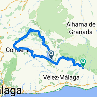
Desafío - La Viñuela- Distance
- 7.2 km
- Ascent
- 115 m
- Descent
- 121 m
- Location
- Viñuela, Andalusia, Spain
Vinuela 40 km loop- Distance
- 42.5 km
- Ascent
- 607 m
- Descent
- 586 m
- Location
- Viñuela, Andalusia, Spain
La Viñuela- Distance
- 30.9 km
- Ascent
- 551 m
- Descent
- 406 m
- Location
- Viñuela, Andalusia, Spain
RouteViñuela - Pireneën van het Zuiden-Archez-Cómpeta- Distance
- 148.9 km
- Ascent
- 2,111 m
- Descent
- 1,779 m
- Location
- Viñuela, Andalusia, Spain
Puente Don Manuel-El Alcazar-La Alcauca-Llanos de Zafarraya-antigua via del tren-Periana-Puente Don Manuel- Distance
- 41 km
- Ascent
- 1,380 m
- Descent
- 1,295 m
- Location
- Viñuela, Andalusia, Spain
Open it in the app


