
Fischbacher-Ost
A cycling route starting in Gloggnitz, Lower Austria, Austria.
Overview
About this route
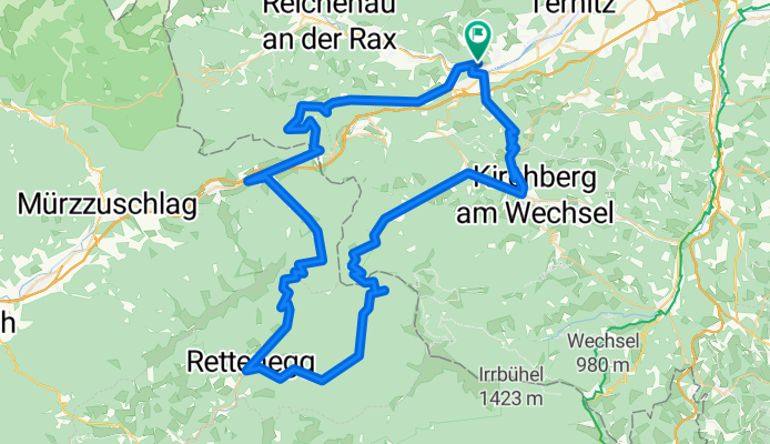
For train users: From BH-Gloggnitz (460m) towards Semmering (950m). Over the old mountain pass road through the Adlitzgräben to the mountain pass. Optionally downhill to Steinhaus (820m) via the old or new road. Turnoff towards Pfaffensattel/Rettenegg. Climb to Pfaffensattel (1370m) max. 20%. Long descent to Rettenegg (860m). Turnoff towards Feistritz-Sattel/Kirchberg. Gradual climb to Feistritz-Sattel (1300m). Descent to Ottenthal (630m). From there either via Raach/Hochgebirge (740m flatter) or Kirchberg/Kranichberg (845m steeper) back to Gloggnitz.
- -:--
- Duration
- 81.9 km
- Distance
- 1,787 m
- Ascent
- 1,787 m
- Descent
- ---
- Avg. speed
- ---
- Max. altitude

Continue with Bikemap
Use, edit, or download this cycling route
You would like to ride Fischbacher-Ost or customize it for your own trip? Here is what you can do with this Bikemap route:
Free features
- Save this route as favorite or in collections
- Copy & plan your own version of this route
- Split it into stages to create a multi-day tour
- Sync your route with Garmin or Wahoo
Premium features
Free trial for 3 days, or one-time payment. More about Bikemap Premium.
- Navigate this route on iOS & Android
- Export a GPX / KML file of this route
- Create your custom printout (try it for free)
- Download this route for offline navigation
Discover more Premium features.
Get Bikemap PremiumFrom our community
Other popular routes starting in Gloggnitz
 Weltkulturerbe Route von Gloggnitz Bahnhof auf den Semmering
- Distance
- 36.2 km
- Ascent
- 1,022 m
- Descent
- 1,021 m
- Location
- Gloggnitz, Lower Austria, Austria
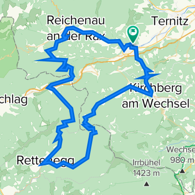 Gloggnitz - Feistritzsattel - Pfaffensattel - Semmering - Reichenau - Gloggnitz
- Distance
- 94.6 km
- Ascent
- 1,783 m
- Descent
- 1,783 m
- Location
- Gloggnitz, Lower Austria, Austria
 Semmering
- Distance
- 103.1 km
- Ascent
- 2,988 m
- Descent
- 2,817 m
- Location
- Gloggnitz, Lower Austria, Austria
 semmering special
- Distance
- 68.9 km
- Ascent
- 1,868 m
- Descent
- 1,871 m
- Location
- Gloggnitz, Lower Austria, Austria
 Gloggnitz - Semmering - Pfaffensattel - Feistritzsattel
- Distance
- 119.3 km
- Ascent
- 2,369 m
- Descent
- 2,369 m
- Location
- Gloggnitz, Lower Austria, Austria
 Semmering 5
- Distance
- 71.6 km
- Ascent
- 1,023 m
- Descent
- 1,023 m
- Location
- Gloggnitz, Lower Austria, Austria
 Fischbacher-Ost
- Distance
- 81.9 km
- Ascent
- 1,787 m
- Descent
- 1,787 m
- Location
- Gloggnitz, Lower Austria, Austria
 Gloggnitz Kreuzberg
- Distance
- 28.6 km
- Ascent
- 1,107 m
- Descent
- 1,105 m
- Location
- Gloggnitz, Lower Austria, Austria
Open it in the app