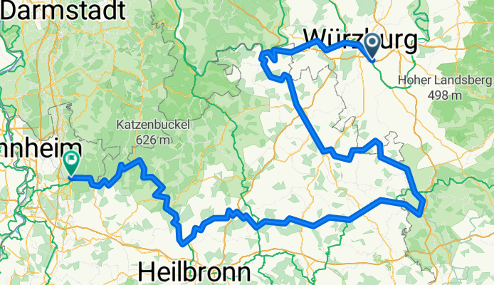
wurzburg heidelberg
A cycling route starting in Randersacker, Bavaria, Germany.
Overview
About this route
- -:--
- Duration
- 343.2 km
- Distance
- 767 m
- Ascent
- 822 m
- Descent
- ---
- Avg. speed
- ---
- Max. altitude
Route quality
Waytypes & surfaces along the route
Waytypes
Track
118.8 km
(35 %)
Quiet road
86.4 km
(25 %)
Surfaces
Paved
274.8 km
(80 %)
Unpaved
27.8 km
(8 %)
Asphalt
252.7 km
(74 %)
Gravel
20.1 km
(6 %)
Continue with Bikemap
Use, edit, or download this cycling route
You would like to ride wurzburg heidelberg or customize it for your own trip? Here is what you can do with this Bikemap route:
Free features
- Save this route as favorite or in collections
- Copy & plan your own version of this route
- Split it into stages to create a multi-day tour
- Sync your route with Garmin or Wahoo
Premium features
Free trial for 3 days, or one-time payment. More about Bikemap Premium.
- Navigate this route on iOS & Android
- Export a GPX / KML file of this route
- Create your custom printout (try it for free)
- Download this route for offline navigation
Discover more Premium features.
Get Bikemap PremiumFrom our community
Other popular routes starting in Randersacker
- Route in Würzburg
- Distance
- 62.4 km
- Ascent
- 575 m
- Descent
- 574 m
- Location
- Randersacker, Bavaria, Germany
- Mainradtour 2013 Fünfte Etappe
- Distance
- 55.5 km
- Ascent
- 85 m
- Descent
- 72 m
- Location
- Randersacker, Bavaria, Germany
- Sonntagsausflug 11.07.21
- Distance
- 100.7 km
- Ascent
- 299 m
- Descent
- 299 m
- Location
- Randersacker, Bavaria, Germany
- Ostwind
- Distance
- 88.1 km
- Ascent
- 402 m
- Descent
- 402 m
- Location
- Randersacker, Bavaria, Germany
- R_Wü_Ochsengrund
- Distance
- 59.5 km
- Ascent
- 367 m
- Descent
- 367 m
- Location
- Randersacker, Bavaria, Germany
- Radtour 2019 - Version 2
- Distance
- 101.6 km
- Ascent
- 77 m
- Descent
- 83 m
- Location
- Randersacker, Bavaria, Germany
- Schloss Frankenberg
- Distance
- 86.4 km
- Ascent
- 309 m
- Descent
- 309 m
- Location
- Randersacker, Bavaria, Germany
- H'hof-Ochsenfurt-Acholshausen-Fuchsstadt-H'hof
- Distance
- 33.3 km
- Ascent
- 256 m
- Descent
- 255 m
- Location
- Randersacker, Bavaria, Germany
Open it in the app