

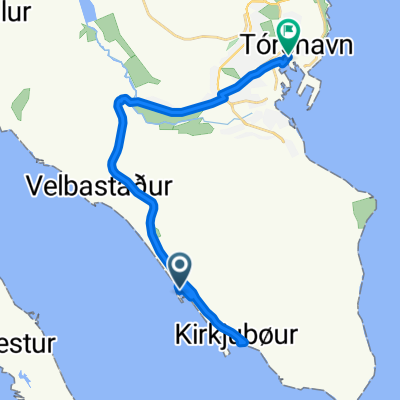
gamlaratt-kirkjubø-tórshavn
A cycling route starting in Argir, Streymoy region, Faroe Islands.
Overview
About this route
- -:--
- Duration
- 15.1 km
- Distance
- 285 m
- Ascent
- 273 m
- Descent
- ---
- Avg. speed
- ---
- Max. altitude

Route quality
Waytypes & surfaces along the route
Waytypes
Road
3 km
(20 %)
Pedestrian area
1.5 km
(10 %)
Surfaces
Paved
1.4 km
(9 %)
Unpaved
0.2 km
(1 %)
Asphalt
1.4 km
(9 %)
Ground
0.2 km
(1 %)
Undefined
13.6 km
(90 %)
Continue with Bikemap
Use, edit, or download this cycling route
You would like to ride gamlaratt-kirkjubø-tórshavn or customize it for your own trip? Here is what you can do with this Bikemap route:
Free features
- Save this route as favorite or in collections
- Copy & plan your own version of this route
- Sync your route with Garmin or Wahoo
Premium features
Free trial for 3 days, or one-time payment. More about Bikemap Premium.
- Navigate this route on iOS & Android
- Export a GPX / KML file of this route
- Create your custom printout (try it for free)
- Download this route for offline navigation
Discover more Premium features.
Get Bikemap PremiumFrom our community
Other popular routes starting in Argir
 gamlaratt-kirkjubø-tórshavn
- Distance
- 15.1 km
- Ascent
- 285 m
- Descent
- 273 m
- Location
- Argir, Streymoy region, Faroe Islands
 f 400
f 400- Distance
- 358 km
- Ascent
- 1,935 m
- Descent
- 1,896 m
- Location
- Argir, Streymoy region, Faroe Islands
 Flatnagerði 25, Thorshavn to Flatnagerði 25, Thorshavn
- Distance
- 62.7 km
- Ascent
- 1,655 m
- Descent
- 1,663 m
- Location
- Argir, Streymoy region, Faroe Islands
 Heidatun 6, Argir to Taulov Kirkevej 66, Fredericia
- Distance
- 1,397.3 km
- Ascent
- 1,039 m
- Descent
- 1,030 m
- Location
- Argir, Streymoy region, Faroe Islands
 Argir Cycling
- Distance
- 2 km
- Ascent
- 0 m
- Descent
- 84 m
- Location
- Argir, Streymoy region, Faroe Islands
 Faroe Islands to Lauritsargøta 12, Tórshavn
- Distance
- 11.7 km
- Ascent
- 179 m
- Descent
- 341 m
- Location
- Argir, Streymoy region, Faroe Islands
 faero
faero- Distance
- 64.3 km
- Ascent
- 0 m
- Descent
- 0 m
- Location
- Argir, Streymoy region, Faroe Islands
 f 200 -300
- Distance
- 318.2 km
- Ascent
- 2,363 m
- Descent
- 2,383 m
- Location
- Argir, Streymoy region, Faroe Islands
Open it in the app