

Itinéraire bis D138
A cycling route starting in Saint-Léger-du-Bourg-Denis, Normandy, France.
Overview
About this route
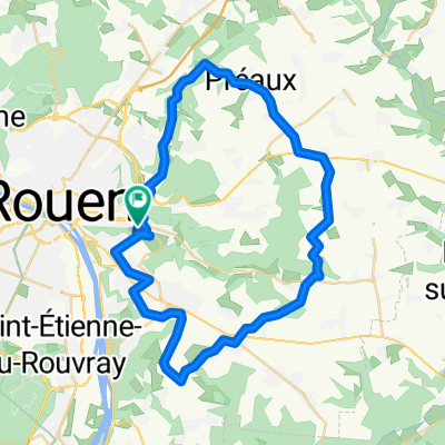
Ancienne D138 St Léger/Mesnil-Esnard
- -:--
- Duration
- 3 km
- Distance
- 107 m
- Ascent
- 4 m
- Descent
- ---
- Avg. speed
- ---
- Max. altitude

Route quality
Waytypes & surfaces along the route
Waytypes
Quiet road
1.5 km
(49 %)
Busy road
0.8 km
(25 %)
Surfaces
Paved
0.7 km
(25 %)
Asphalt
0.7 km
(25 %)
Undefined
2.3 km
(75 %)
Continue with Bikemap
Use, edit, or download this cycling route
You would like to ride Itinéraire bis D138 or customize it for your own trip? Here is what you can do with this Bikemap route:
Free features
- Save this route as favorite or in collections
- Copy & plan your own version of this route
- Sync your route with Garmin or Wahoo
Premium features
Free trial for 3 days, or one-time payment. More about Bikemap Premium.
- Navigate this route on iOS & Android
- Export a GPX / KML file of this route
- Create your custom printout (try it for free)
- Download this route for offline navigation
Discover more Premium features.
Get Bikemap PremiumFrom our community
Other popular routes starting in Saint-Léger-du-Bourg-Denis
 vers la neuville retour belbeuf
- Distance
- 37.4 km
- Ascent
- 387 m
- Descent
- 387 m
- Location
- Saint-Léger-du-Bourg-Denis, Normandy, France
 U300 - Rouen 45km
- Distance
- 45.6 km
- Ascent
- 273 m
- Descent
- 273 m
- Location
- Saint-Léger-du-Bourg-Denis, Normandy, France
 mont saint aignan
- Distance
- 24.3 km
- Ascent
- 258 m
- Descent
- 258 m
- Location
- Saint-Léger-du-Bourg-Denis, Normandy, France
 test VTT
- Distance
- 9.7 km
- Ascent
- 212 m
- Descent
- 213 m
- Location
- Saint-Léger-du-Bourg-Denis, Normandy, France
 Itinéraire bis D138
- Distance
- 3 km
- Ascent
- 107 m
- Descent
- 4 m
- Location
- Saint-Léger-du-Bourg-Denis, Normandy, France
 st leger - ymare allez
- Distance
- 14.9 km
- Ascent
- 201 m
- Descent
- 146 m
- Location
- Saint-Léger-du-Bourg-Denis, Normandy, France
 bois du roule
- Distance
- 12.2 km
- Ascent
- 272 m
- Descent
- 271 m
- Location
- Saint-Léger-du-Bourg-Denis, Normandy, France
 Etape 01 Rouen - Trouville-Alliquerville 60 Km
- Distance
- 59.6 km
- Ascent
- 560 m
- Descent
- 446 m
- Location
- Saint-Léger-du-Bourg-Denis, Normandy, France
Open it in the app