

Pieniny
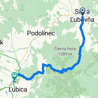
A cycling route starting in Stará Ľubovňa, Prešov Region, Slovakia.
Overview
About this route
- -:--
- Duration
- 65 km
- Distance
- 689 m
- Ascent
- 691 m
- Descent
- ---
- Avg. speed
- ---
- Max. altitude
Route quality
Waytypes & surfaces along the route
Waytypes
Road
16.3 km
(25 %)
Track
7.2 km
(11 %)
Surfaces
Paved
44.9 km
(69 %)
Unpaved
5.9 km
(9 %)
Asphalt
38.4 km
(59 %)
Concrete
6.5 km
(10 %)
Route highlights
Points of interest along the route

Point of interest after 10.8 km

Point of interest after 11.9 km

Point of interest after 12.2 km

Point of interest after 13 km

Point of interest after 13.4 km

Point of interest after 14.6 km

Point of interest after 17.7 km

Point of interest after 25.9 km

Point of interest after 30.6 km

Point of interest after 34.4 km

Point of interest after 51.5 km
Continue with Bikemap
Use, edit, or download this cycling route
You would like to ride Pieniny or customize it for your own trip? Here is what you can do with this Bikemap route:
Free features
- Save this route as favorite or in collections
- Copy & plan your own version of this route
- Sync your route with Garmin or Wahoo
Premium features
Free trial for 3 days, or one-time payment. More about Bikemap Premium.
- Navigate this route on iOS & Android
- Export a GPX / KML file of this route
- Create your custom printout (try it for free)
- Download this route for offline navigation
Discover more Premium features.
Get Bikemap PremiumFrom our community
Other popular routes starting in Stará Ľubovňa
 Litmanova - Zvir cez vabec
- Distance
- 25.9 km
- Ascent
- 500 m
- Descent
- 500 m
- Location
- Stará Ľubovňa, Prešov Region, Slovakia
 Unnamed Road, Stará Ľubovňa do Litmanová
- Distance
- 10 km
- Ascent
- 141 m
- Descent
- 72 m
- Location
- Stará Ľubovňa, Prešov Region, Slovakia
 SL Kotnik Kolackov
- Distance
- 49.1 km
- Ascent
- 739 m
- Descent
- 738 m
- Location
- Stará Ľubovňa, Prešov Region, Slovakia
 Šambron
- Distance
- 28.9 km
- Ascent
- 535 m
- Descent
- 535 m
- Location
- Stará Ľubovňa, Prešov Region, Slovakia
 Stará Ľubovňa - Malý Václavák - Zlatná - Kežmaro
- Distance
- 41.7 km
- Ascent
- 760 m
- Descent
- 688 m
- Location
- Stará Ľubovňa, Prešov Region, Slovakia
 St.Ľubovňa-Osly- Hliniská- Ľubovn. hrad
- Distance
- 18.6 km
- Ascent
- 469 m
- Descent
- 472 m
- Location
- Stará Ľubovňa, Prešov Region, Slovakia
 St.Ľubovňa- Ľub.kúpele -Plavnica- Údol- Plaveč (hrad)
- Distance
- 23.6 km
- Ascent
- 455 m
- Descent
- 468 m
- Location
- Stará Ľubovňa, Prešov Region, Slovakia
 St.Ľubovňa- N.Ľubovňa -Ľub. kúpele- Jakubany
- Distance
- 20 km
- Ascent
- 390 m
- Descent
- 391 m
- Location
- Stará Ľubovňa, Prešov Region, Slovakia
Open it in the app