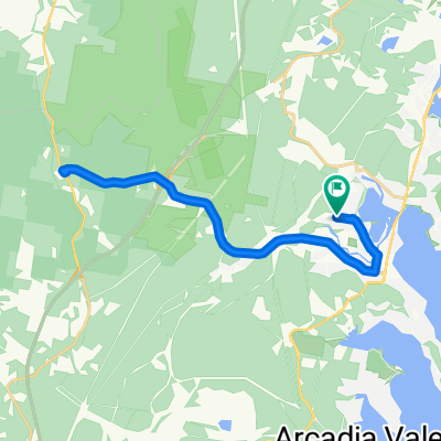
Thirty Minute Local Plod - Blackalls Park - Toronto
A cycling route starting in Fennell Bay, New South Wales, Australia.
Overview
About this route
A compendium of bits of several recent rides.
-
From Blackalls Park Public School's gate at the corner of Rupert and Todd Streets, travel 125 metres south-west to the coner with Faucett Street.
-
Turn left into Faucett Street and travel 300 metres south-east to the left kink in Faucett Street.
-
Veer left into the long downhill straight of Faucett Street and continue east about 590 metres to the Fennell Crescent intersection.
-
Turn right into Fennell Crescent and travel its full length to where it joins Railway Parade near Stoney Creek.
-
From Stony Creek, travel south to Thorne Street. Go LEFT into Thorne then ride EAST to Cary Street.
-
Make a LEFT into Cary then travel NORTH to the Greenway-Cycleway entry opposite Victory Parade.
-
Take a LEFT and travel the Greenway-Cycleway back over the Stony Creek Bridge. Make a RIGHT into Lake Street and travel NORTH the short way to Venetia Avenue.
-
Travel north-west to the end of Venetia then cross the ricketty wooden bridge and take the narrow laneway to Railway North Parade.
-
Travel parallel to the old railway line back to Faucett Street.
-
Take a right into Bayview Avenue THEN travel to the entry way to Blackalls Park Community Park.
-
Turn hard left onto Blackall Avenue and ride west to its end. Cross the link path to the Greenway-Cycleway and travel NORTH to Rose Street.
-
Go 30 metres up Rose Street then U-turn and rejoin the Cycleway with a right turn.
-
Ride to the corner of Centre Avenue (Liquor Store and Ocean Melody Chinese Restaurant).
-
Enter Centre Avenue.
-
Soon, a quick VEER into Rhodes Street, left onto Charles Street and then home via a right turn to Rupert and a quick left turn into Todd.
- -:--
- Duration
- 7.8 km
- Distance
- 58 m
- Ascent
- 54 m
- Descent
- ---
- Avg. speed
- ---
- Max. altitude
Continue with Bikemap
Use, edit, or download this cycling route
You would like to ride Thirty Minute Local Plod - Blackalls Park - Toronto or customize it for your own trip? Here is what you can do with this Bikemap route:
Free features
- Save this route as favorite or in collections
- Copy & plan your own version of this route
- Sync your route with Garmin or Wahoo
Premium features
Free trial for 3 days, or one-time payment. More about Bikemap Premium.
- Navigate this route on iOS & Android
- Export a GPX / KML file of this route
- Create your custom printout (try it for free)
- Download this route for offline navigation
Discover more Premium features.
Get Bikemap PremiumFrom our community
Other popular routes starting in Fennell Bay
 Blackalls Park Public School to Toronto Pool +
- Distance
- 10.5 km
- Ascent
- 67 m
- Descent
- 66 m
- Location
- Fennell Bay, New South Wales, Australia
 BPPS to Freemans Waterhole Subway
- Distance
- 28.6 km
- Ascent
- 197 m
- Descent
- 197 m
- Location
- Fennell Bay, New South Wales, Australia
 13.5km plus Suburban Run
- Distance
- 14.2 km
- Ascent
- 80 m
- Descent
- 83 m
- Location
- Fennell Bay, New South Wales, Australia
 Bay Lap and Lunch at McCafe TOR
- Distance
- 13 km
- Ascent
- 84 m
- Descent
- 81 m
- Location
- Fennell Bay, New South Wales, Australia
 Another Local Suburban Exercise Course
- Distance
- 11.9 km
- Ascent
- 83 m
- Descent
- 86 m
- Location
- Fennell Bay, New South Wales, Australia
 Lapped Fennell Bay & Edmunds Bay + Toronto Shops
- Distance
- 11.2 km
- Ascent
- 87 m
- Descent
- 85 m
- Location
- Fennell Bay, New South Wales, Australia
 Around Fennell Bay & connected suburbs
- Distance
- 13.2 km
- Ascent
- 82 m
- Descent
- 94 m
- Location
- Fennell Bay, New South Wales, Australia
 Blackalls Park - THS - Toronto - home - 10.5km
- Distance
- 10.7 km
- Ascent
- 81 m
- Descent
- 80 m
- Location
- Fennell Bay, New South Wales, Australia
Open it in the app


