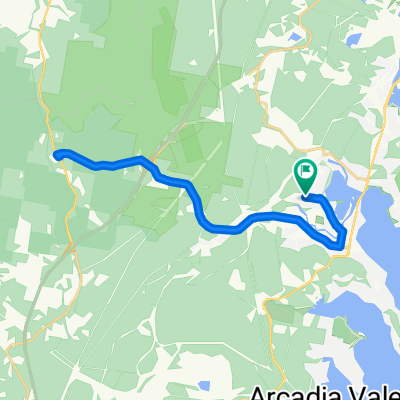
Lapped Fennell Bay & Edmunds Bay + Toronto Shops
- 11.2 km
- 87 m
- 85 m
- Fennell Bay, New South Wales, Australia
A cycling route starting in Fennell Bay, New South Wales, Australia.
Overview
To Toronto via Greenway-Cycleway. Pick up coffee in The Boulevard.
Back past Toronto Railway Station, the Royal Motor Yacht Club, Toronto Public School THEN via Renwick Street to Toronto Lions' Club Park.
Cross Fennell Bay Bridge (travelling north) then walk your bike across the Main Road to Ottey's Lane.
Travel in streets parallel to the Fennell Bay waterfront to Brougham Avenue. Right Turn (Brougham Ave) then Left Turn into Macquarie Road.
Travel about 1.42km and access the bush track off the access lane to Fassifern Rsail Station. Turn east onto the Greenway-Cycleway and travel to Blackalls Park.
Utilise the path that links The Greenway-Cycleway to North Parade. Travel 320m south-east on North Parade.
Turn right onto Faucett THEN quickly LEFT onto Railway Parade ... After 220m, execute a RIGHT turn into Adam Street, a RIGHT into Fennell Crescent, a RIGHT into Faucett Street and a LEFT onto Railway Parade.
At the liquor store & Chinese Restaurant, turn left into Centre Avenue. Then a minor kink into Rhodes Street, a LEFT into Charles Street, a RIGHT into Faucett Street THEN a final RIGHT into Rupert Street.
Travel just 120 metres downhill THEN swing LEFT into the Todd Street cul-de-sac. You are now less than 80 metres from your original starting point.
WELL DONE!
created this 7 years ago
Continue with Bikemap
You would like to ride Around Fennell Bay & connected suburbs or customize it for your own trip? Here is what you can do with this Bikemap route:
Free trial for 3 days, or one-time payment. More about Bikemap Premium.
Discover more Premium features.
Get Bikemap PremiumFrom our community
Open it in the app