

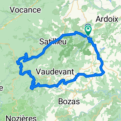
balade 2019.02.22
A cycling route starting in Quintenas, Auvergne-Rhône-Alpes, France.
Overview
About this route
- 3 h 15 min
- Duration
- 8.9 km
- Distance
- 378 m
- Ascent
- 351 m
- Descent
- 2.8 km/h
- Avg. speed
- ---
- Max. altitude

Continue with Bikemap
Use, edit, or download this cycling route
You would like to ride balade 2019.02.22 or customize it for your own trip? Here is what you can do with this Bikemap route:
Free features
- Save this route as favorite or in collections
- Copy & plan your own version of this route
- Sync your route with Garmin or Wahoo
Premium features
Free trial for 3 days, or one-time payment. More about Bikemap Premium.
- Navigate this route on iOS & Android
- Export a GPX / KML file of this route
- Create your custom printout (try it for free)
- Download this route for offline navigation
Discover more Premium features.
Get Bikemap PremiumFrom our community
Other popular routes starting in Quintenas
 balade St jeure 2018-06-02
- Distance
- 7.9 km
- Ascent
- 748 m
- Descent
- 738 m
- Location
- Quintenas, Auvergne-Rhône-Alpes, France
 Ardoix - Lamastre
- Distance
- 52.1 km
- Ascent
- 886 m
- Descent
- 818 m
- Location
- Quintenas, Auvergne-Rhône-Alpes, France
 Lengthy ride through Étables
- Distance
- 54.6 km
- Ascent
- 632 m
- Descent
- 612 m
- Location
- Quintenas, Auvergne-Rhône-Alpes, France
 lalouvesc
- Distance
- 57 km
- Ascent
- 1,727 m
- Descent
- 1,730 m
- Location
- Quintenas, Auvergne-Rhône-Alpes, France
 Saint-Jeure-d'Ay Col du Juvenet par les Hubas
- Distance
- 21.7 km
- Ascent
- 357 m
- Descent
- 357 m
- Location
- Quintenas, Auvergne-Rhône-Alpes, France
 De Rue de Valernaud 25, Quintenas à Quai d'Amérique 6001, Calais
- Distance
- 1,295.7 km
- Ascent
- 4,521 m
- Descent
- 4,888 m
- Location
- Quintenas, Auvergne-Rhône-Alpes, France
 Eclassan
- Distance
- 40.6 km
- Ascent
- 720 m
- Descent
- 713 m
- Location
- Quintenas, Auvergne-Rhône-Alpes, France
 balade 2019.02.22
- Distance
- 8.9 km
- Ascent
- 378 m
- Descent
- 351 m
- Location
- Quintenas, Auvergne-Rhône-Alpes, France
Open it in the app